
Before coming here, I knew nothing about Capitol Reef other than everyone always talks about the pies. I’ve also always thought the name was kinda weird and wondered where it came from. My expectations were super low but I definitely knew we couldn’t skip it.
We’d spent the night at Whispering Sands Motel in Hanksville, UT the night before, then headed out a little after sunrise to make the 45-ish minute drive to the Hickman Bridge trailhead. We entered the park at 7:45am on April 8. 🙂

If you know anything about Utah, you know they’re all about Mormons. I had no idea how much of the history of Capitol Reef would be based on how Mormon settlers shaped these lands. This park is basically a re-telling of this specific group of Mormons who sought solace here because they were kinda black sheep of their communities. Butch Cassidy hid out here too, and apparently these lands were a popular refuge for moonshiners.
The National Park Service also does a pretty good job doing parallel education about how the original, indigenous, people (the Fremont people, then Paiute) used and lived on these lands too. One of my favorite petroglyphs is here. You’ll seeeee.

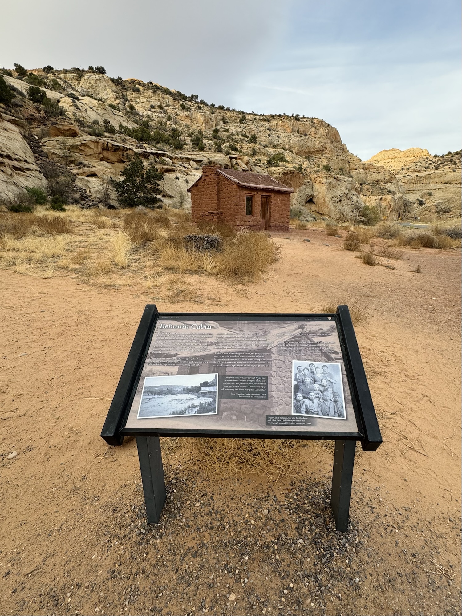

This is the first Mormon historical thing you come across when you’re entering Capitol Reef from the east entrance.
“Behunin Cabin: The modest home before you stands as a reminder of the hardships of early settlers. The desire to exercise religious freedom and create new self-sufficient communities ultimately led many Mormon settlers to this remote part of Utah. This one room cabin was built in 1882 by Elijah Cutler Behunin and his family . They were some of the earliest pioneers to attempt to establish homesteads in the Capitol Reef area.
“Homesteading this rugged, unforgiving landscape brought constant challenges. Isolation and rigorous work allowed little opportunity for socializing with other settlers. The same desert climate that provided fine growing conditions for crops also brought summer thunderstorms and frequent flash foods. Torrential floodwaters often covered won roads with boulders and plant debris, and regularly obliterated diversion dams and ditches. Repairs were always needed.
“Within a year of building this cabin, the Behunin family moved away in search of a more suitable location. Repeated floods on the Fremont River had quickly ruined their irrigation system and washed out their crops. They eventually moved up-canyon to the higher ground of Fruita, becoming one of the first familities to settle in that area...”
He & his wife Tabitha are in that photo with 11 of their 13 (!!!!) kids in 1896.


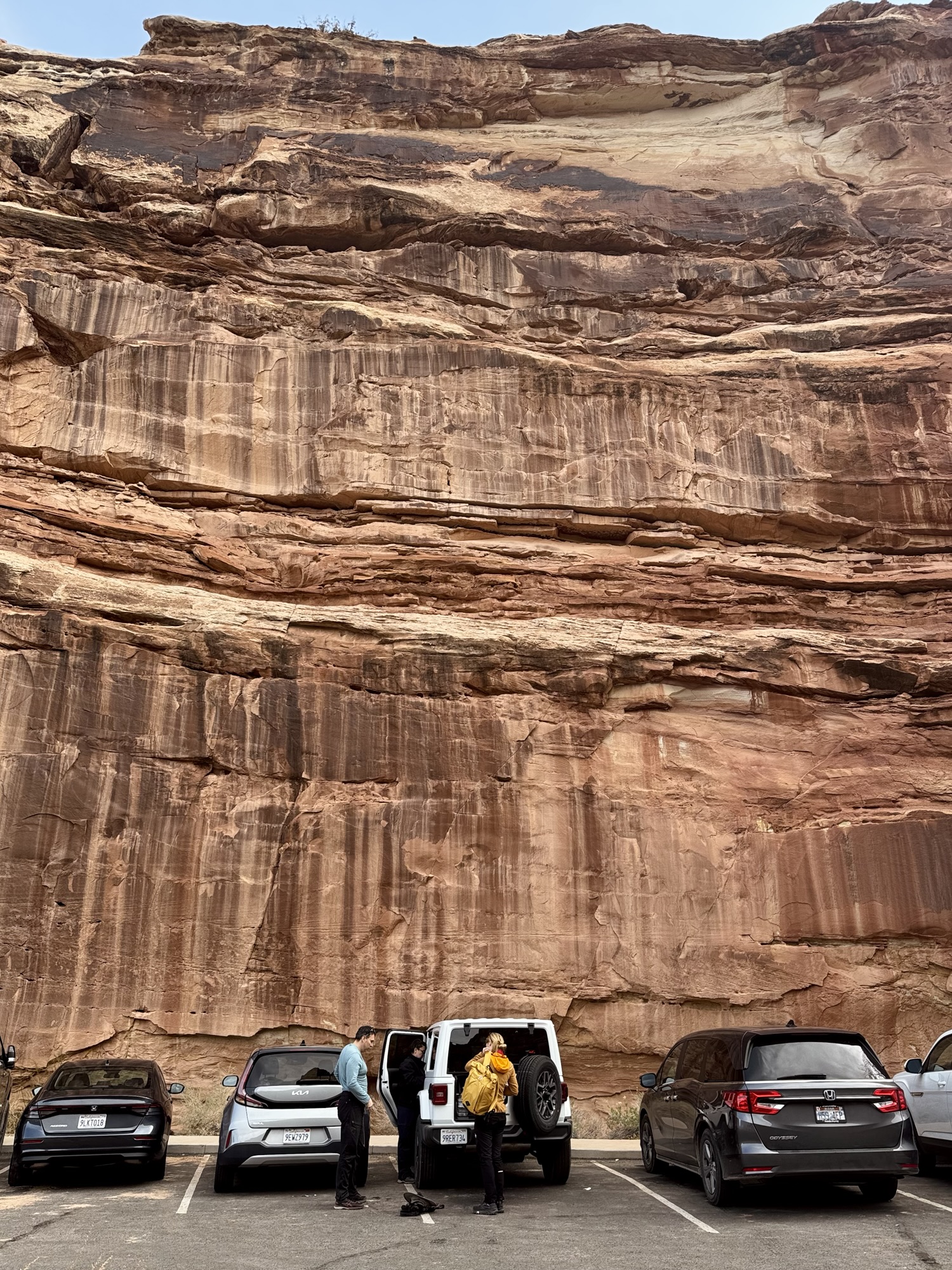
By the time we got to the parking lot around 8am, it was nearly full and buzzing with people getting ready for their hikes. Lots of bike riding people too.
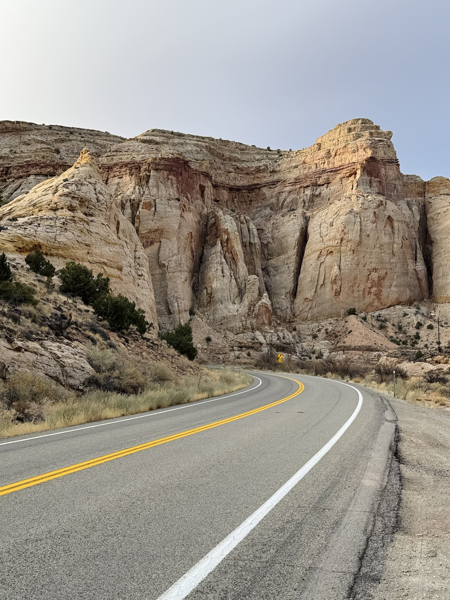
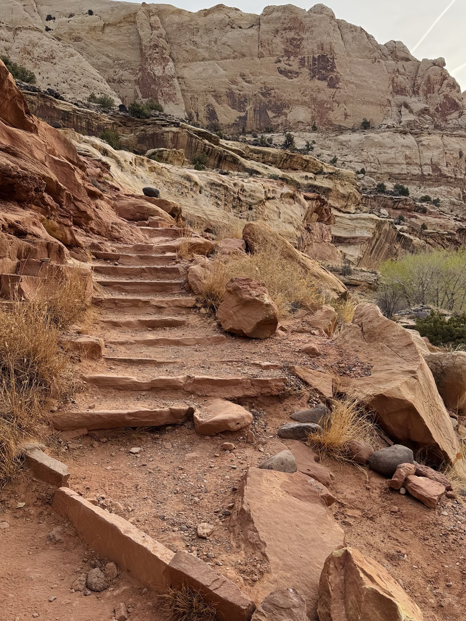
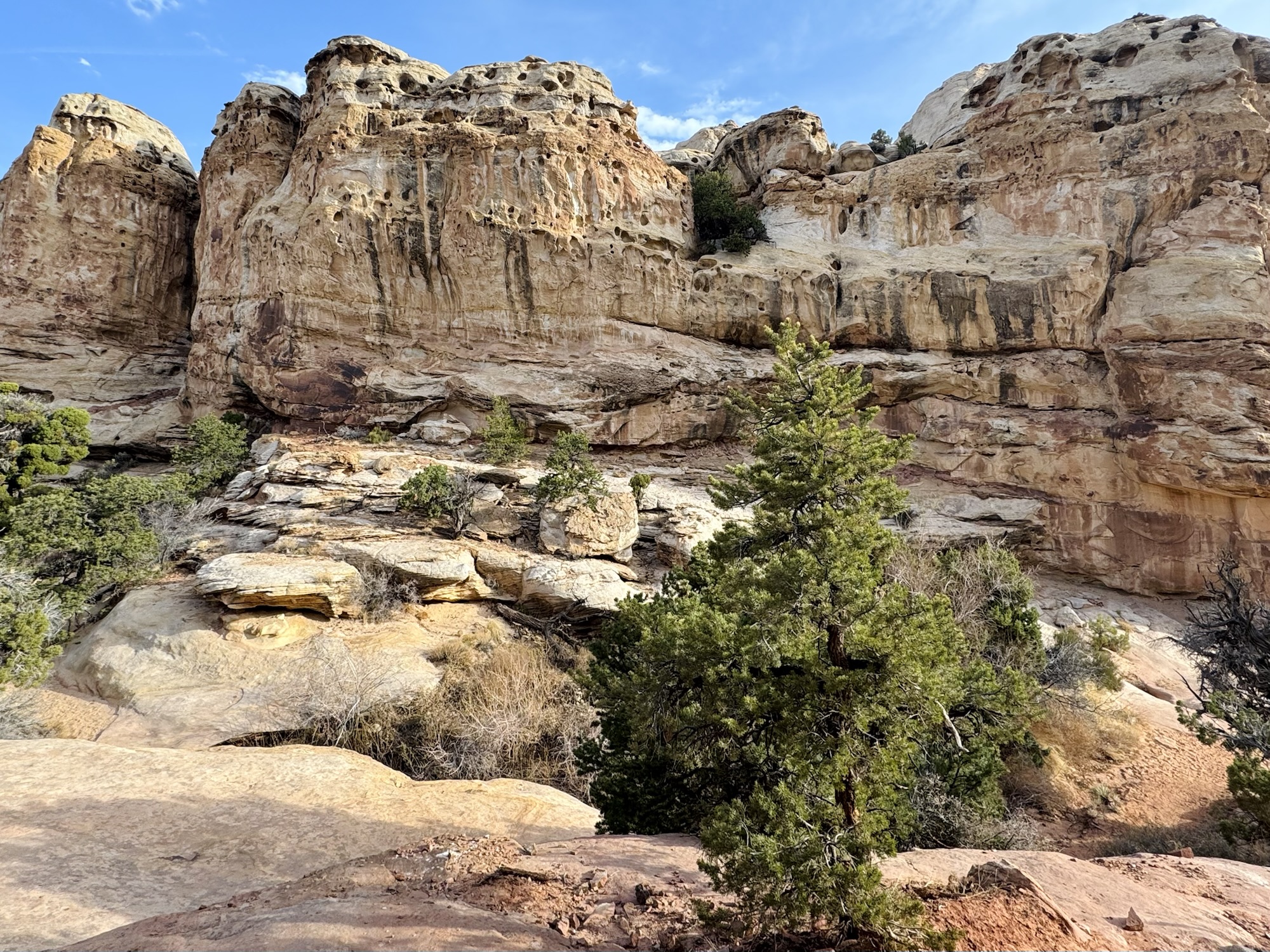
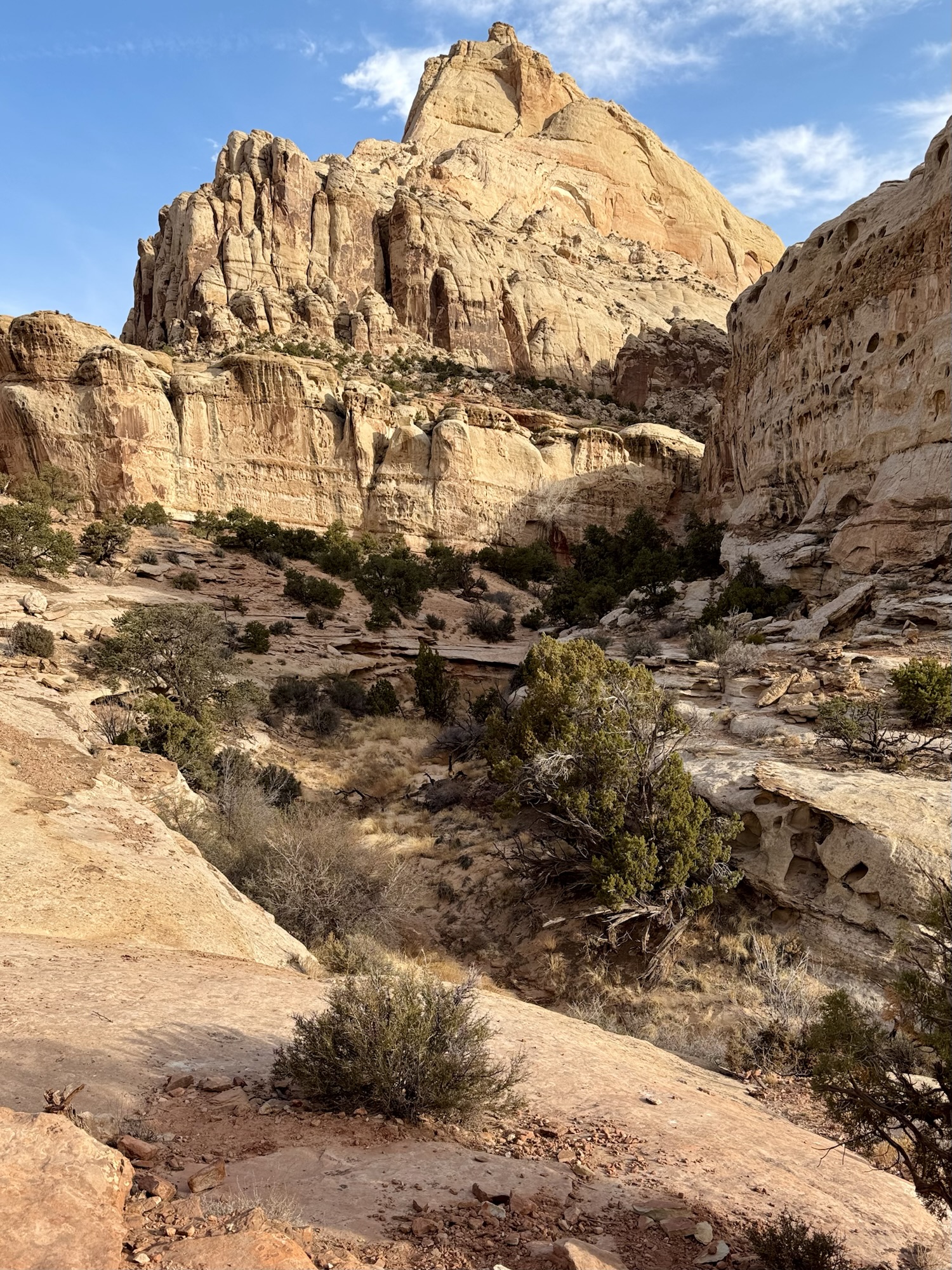
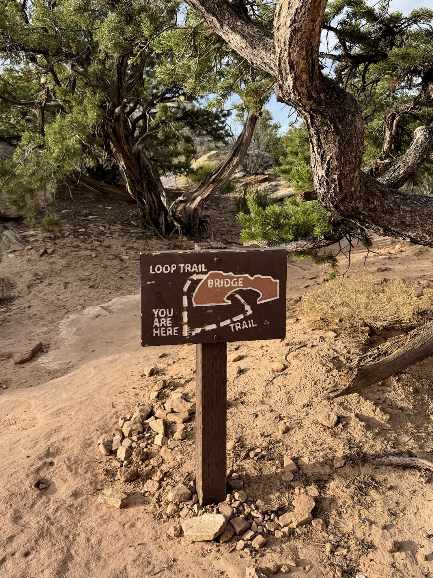
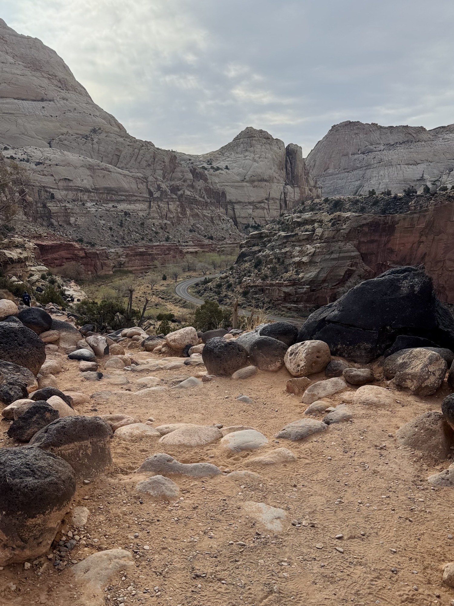
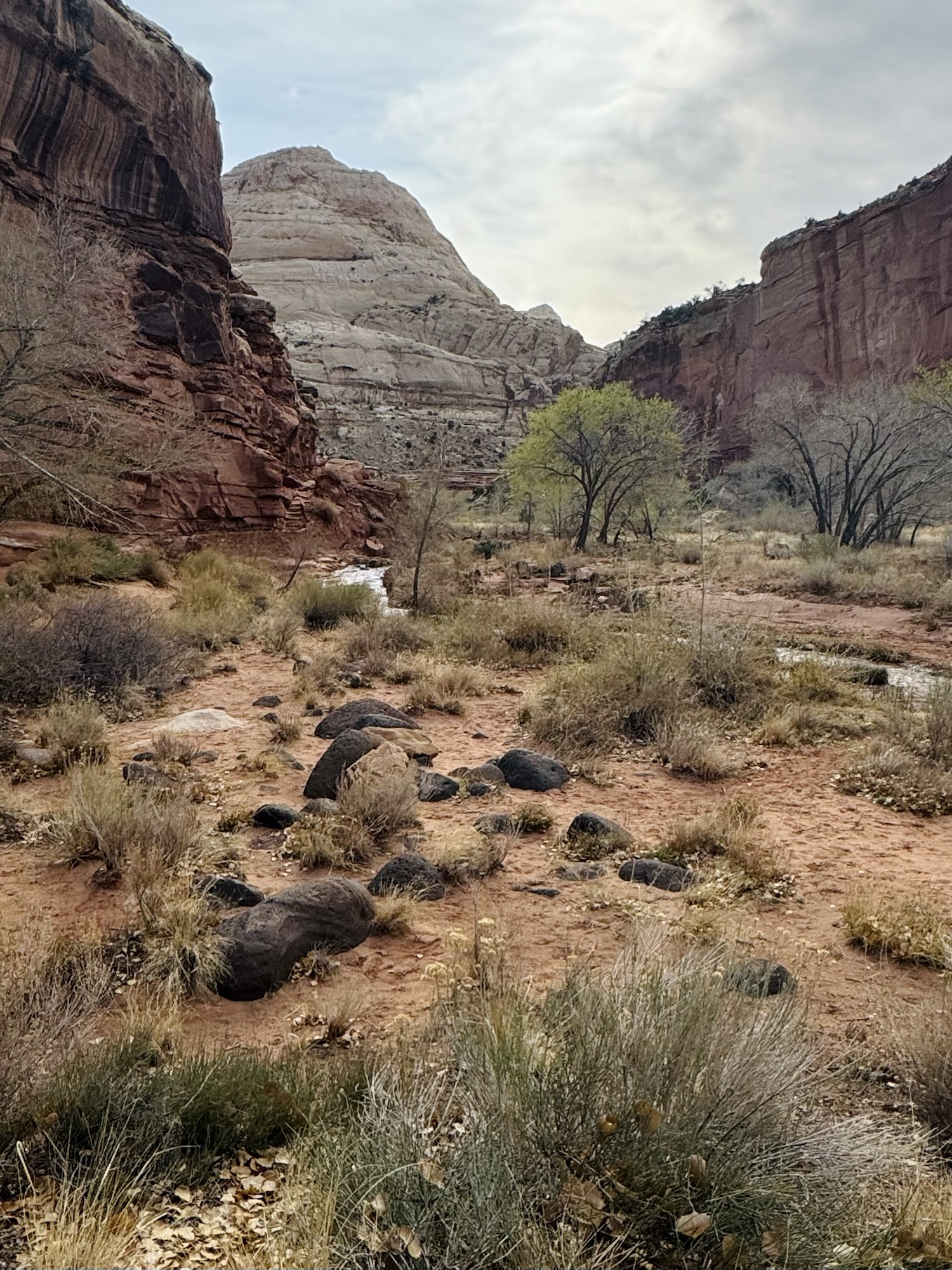
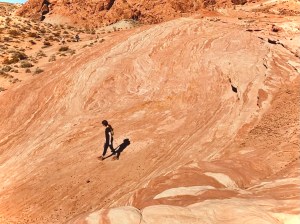
The trail is a little under two miles and starts as a paved sidewalk and the gradually turns into a packed down sandy trail that meanders around so. much. beautiful. sandstone. and through a field that became gradually became more and more covered by black boulders of different sizes.


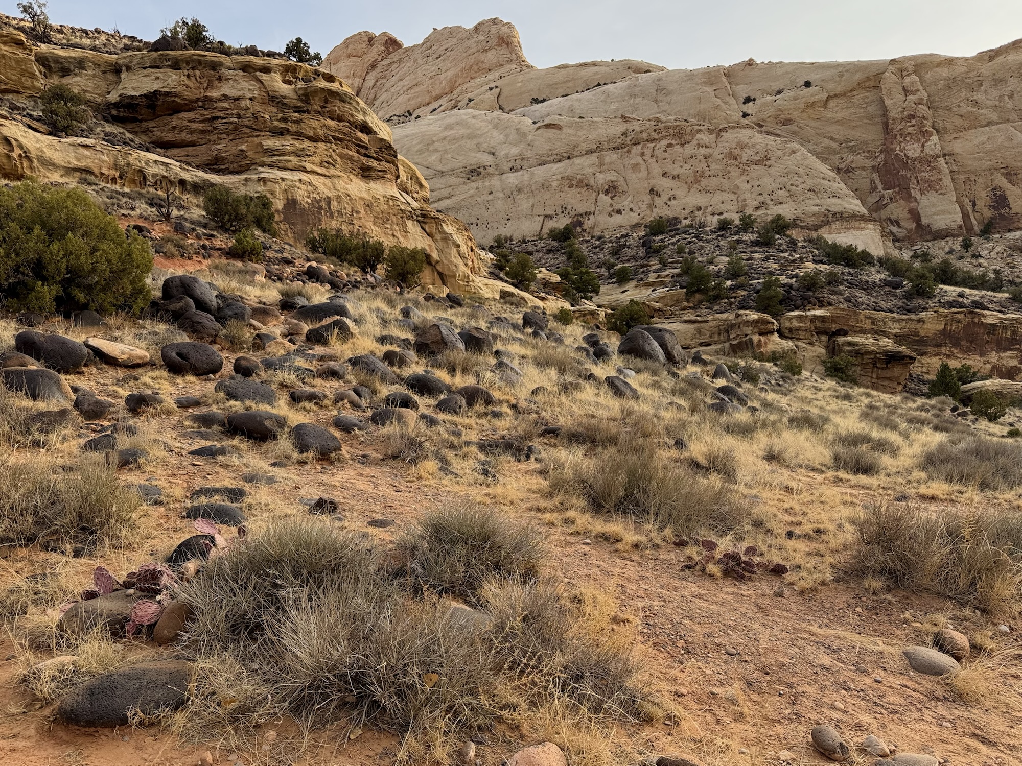


The rocks here reminded me so much of ones we’d seen in Lassen Volcanic National Park a few years ago. On this trail, you can pick up an interpretive trail guide that tells you what you’re looking at as you walk. Apparently, these black boulders are from the tops of neighboring mountains and have gradually tumbled into the valleys of Capitol Reef via flooding and riverflow. They look just like lava rocks to me, but after reading about them while making this post… I guess they’re not? But they’re still so awesome. Some of them are really huge.


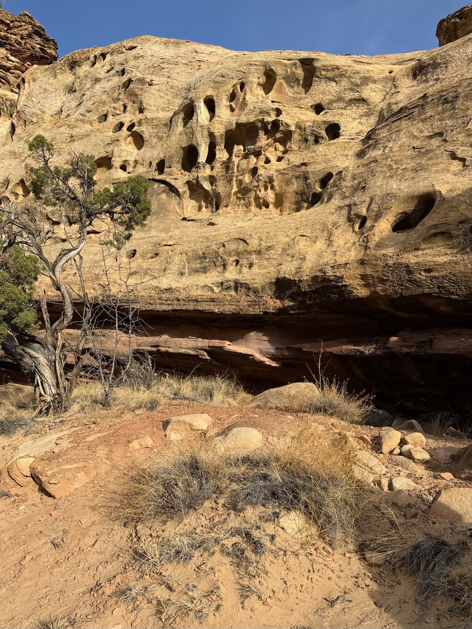
I loooove finding the U.S. Geological Survey markers. I also think it’s really cool when the rocks are marked like this. It’s just so obvious the way that water has carved everything over time.

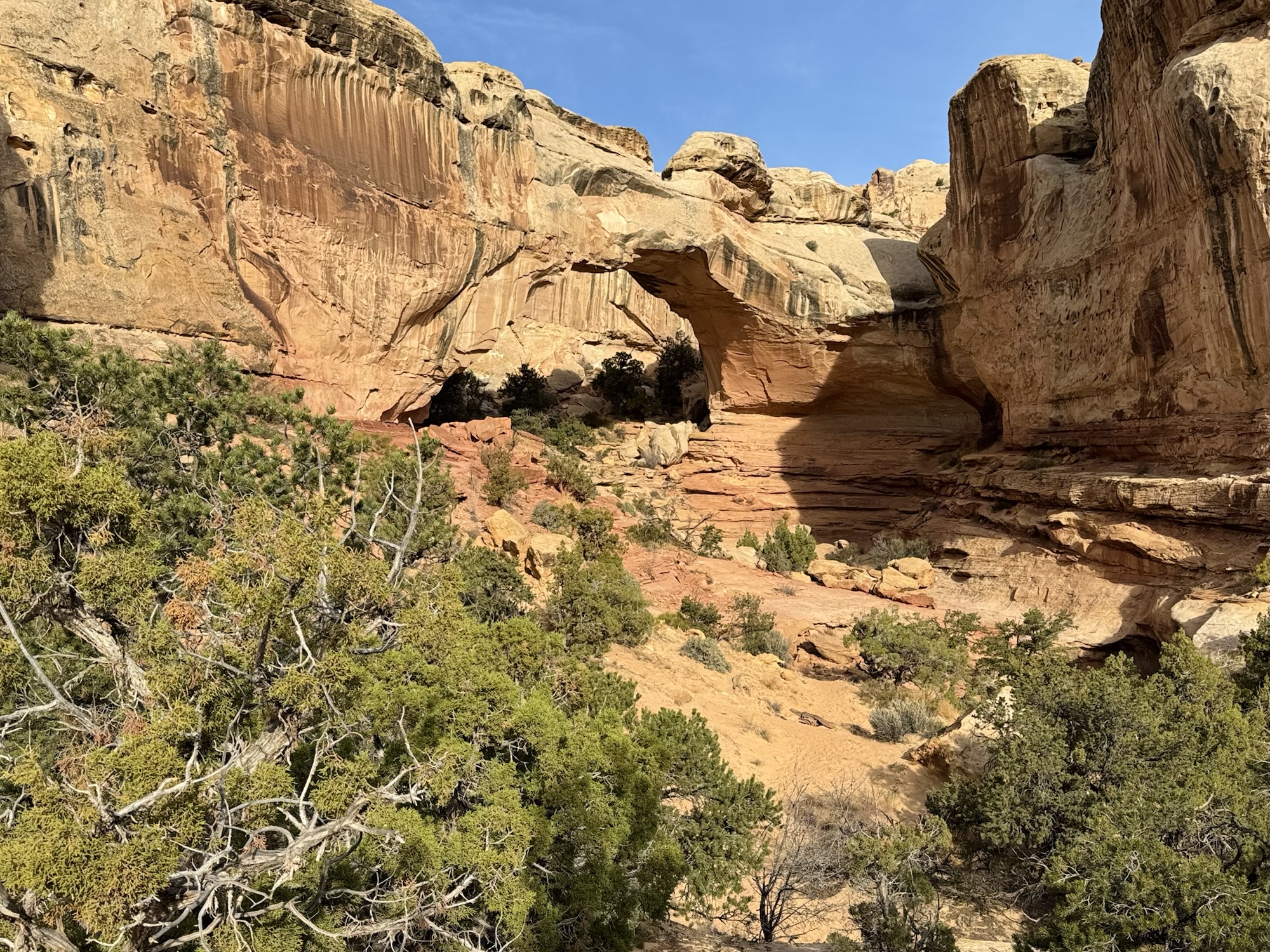
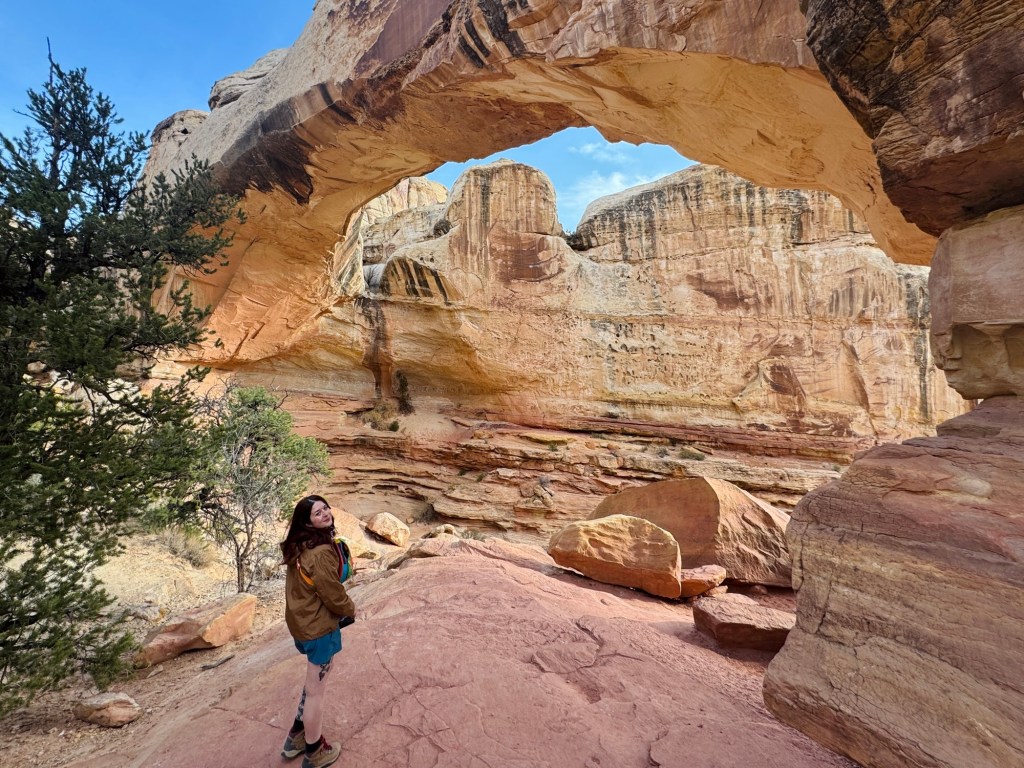
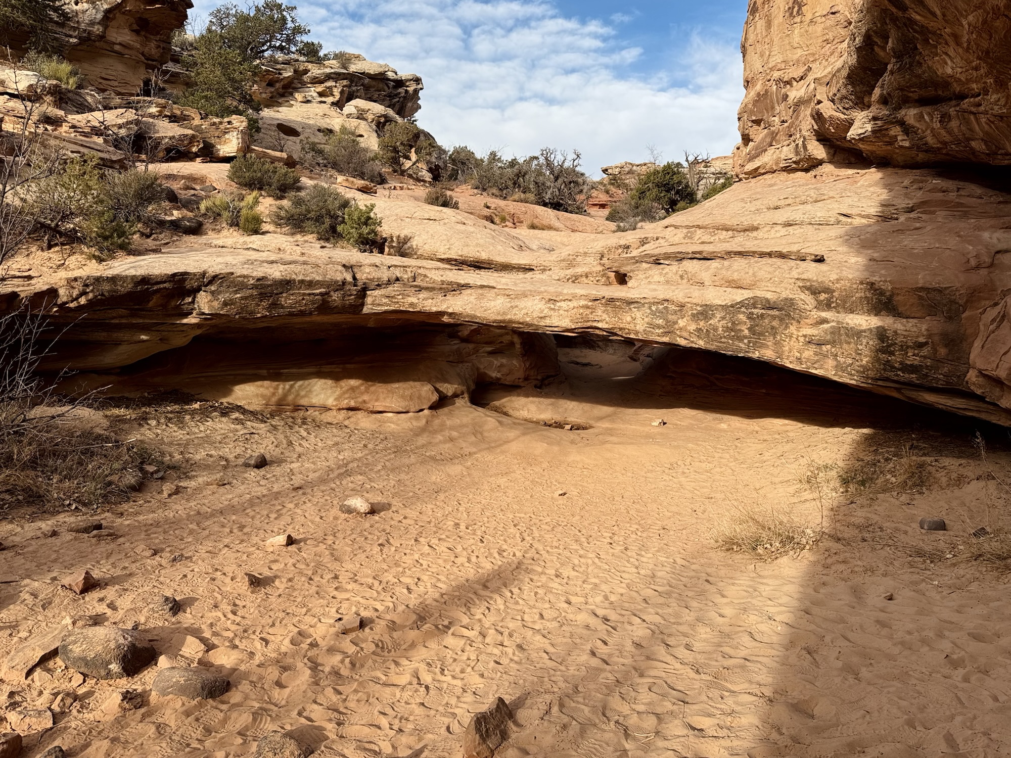
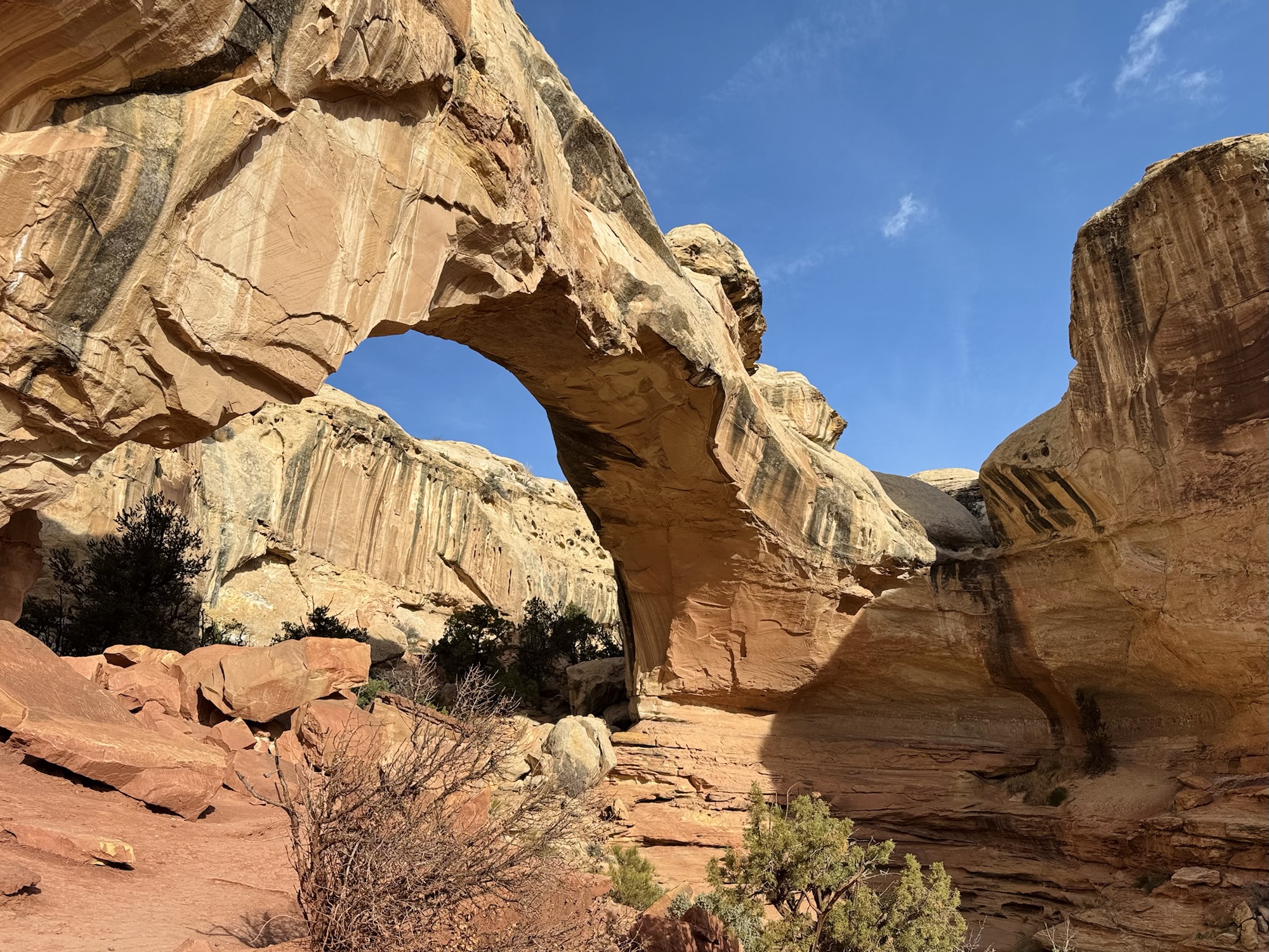
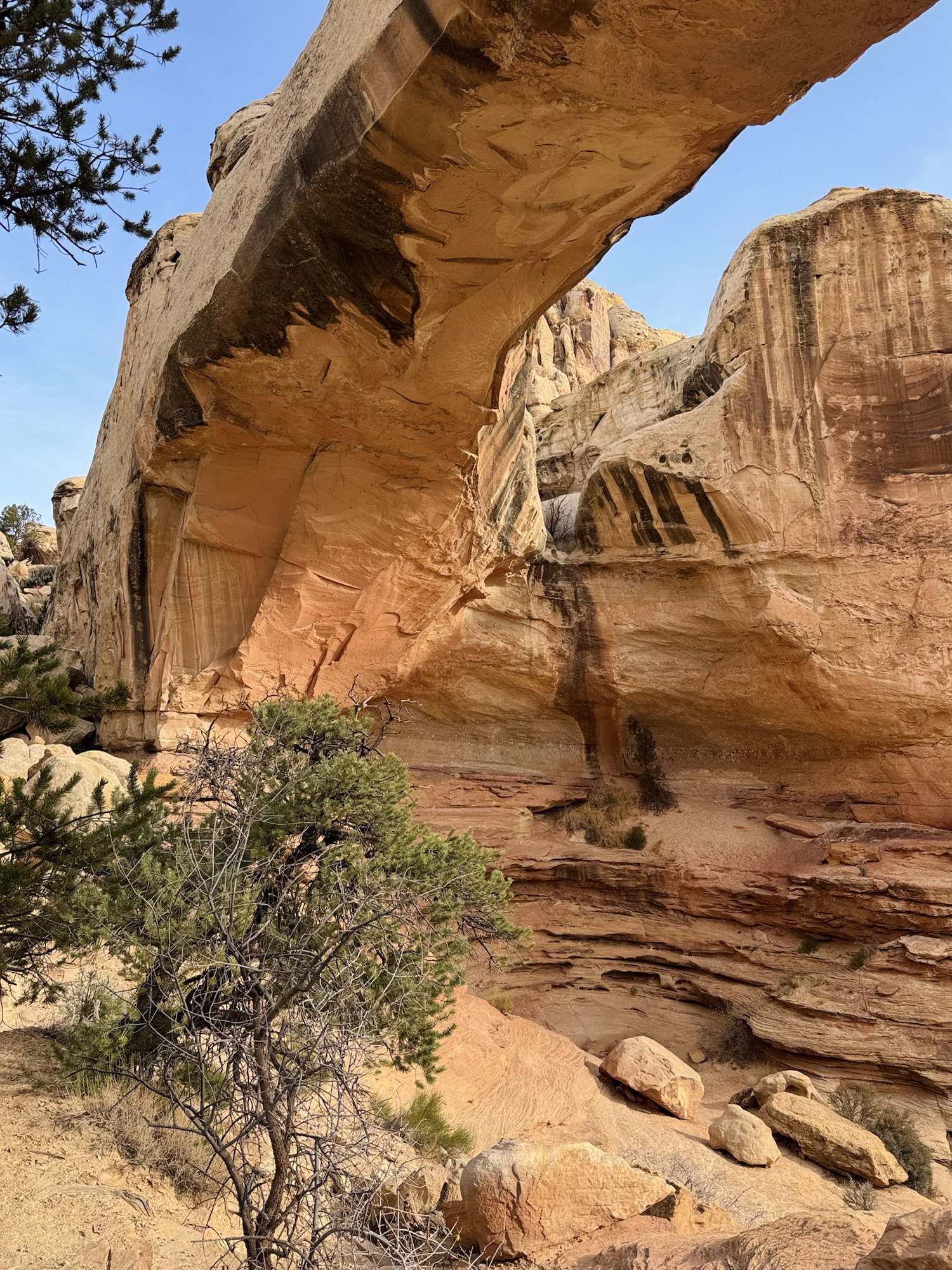
There she is! Big ol’ natural bridge.
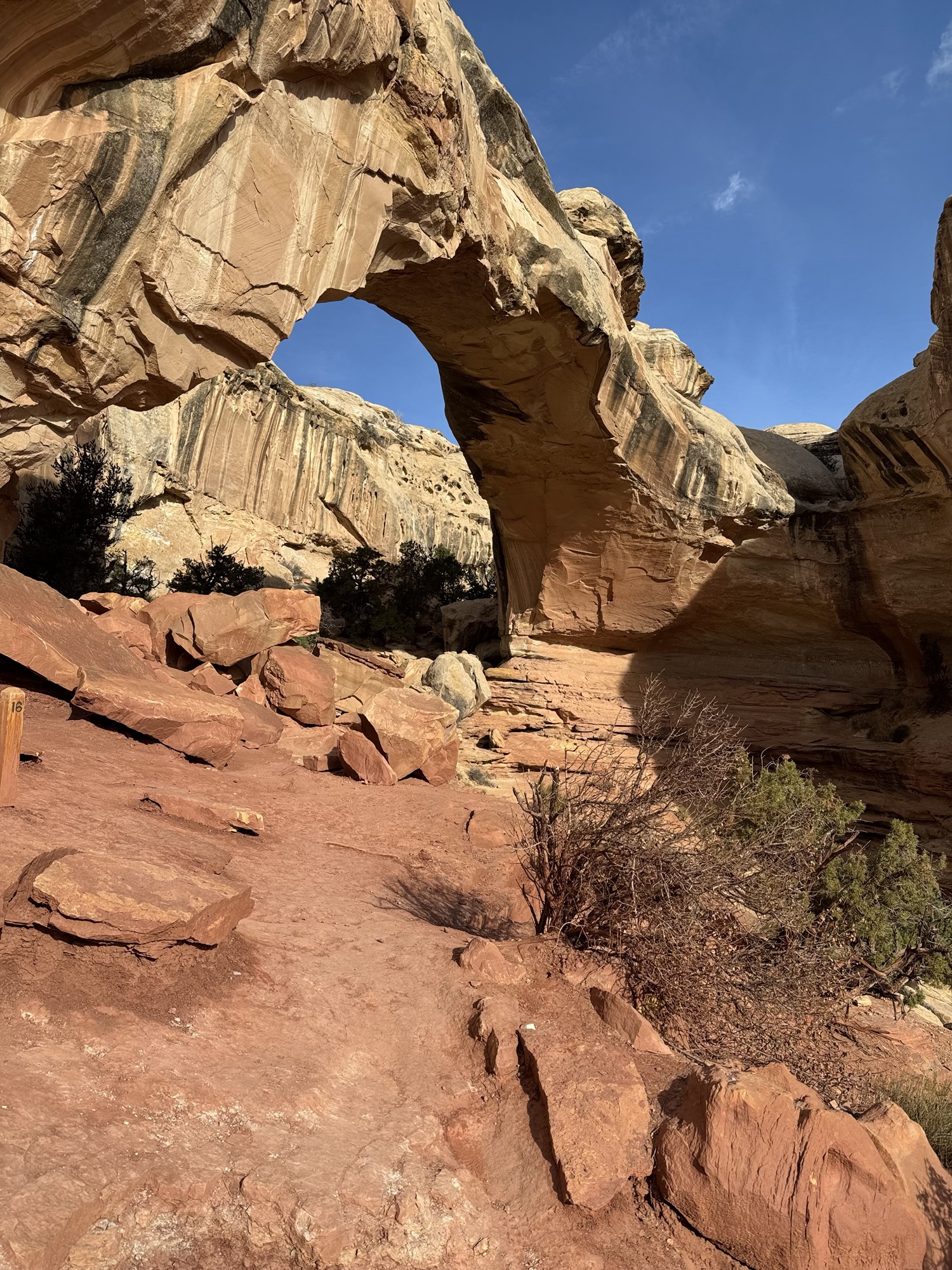
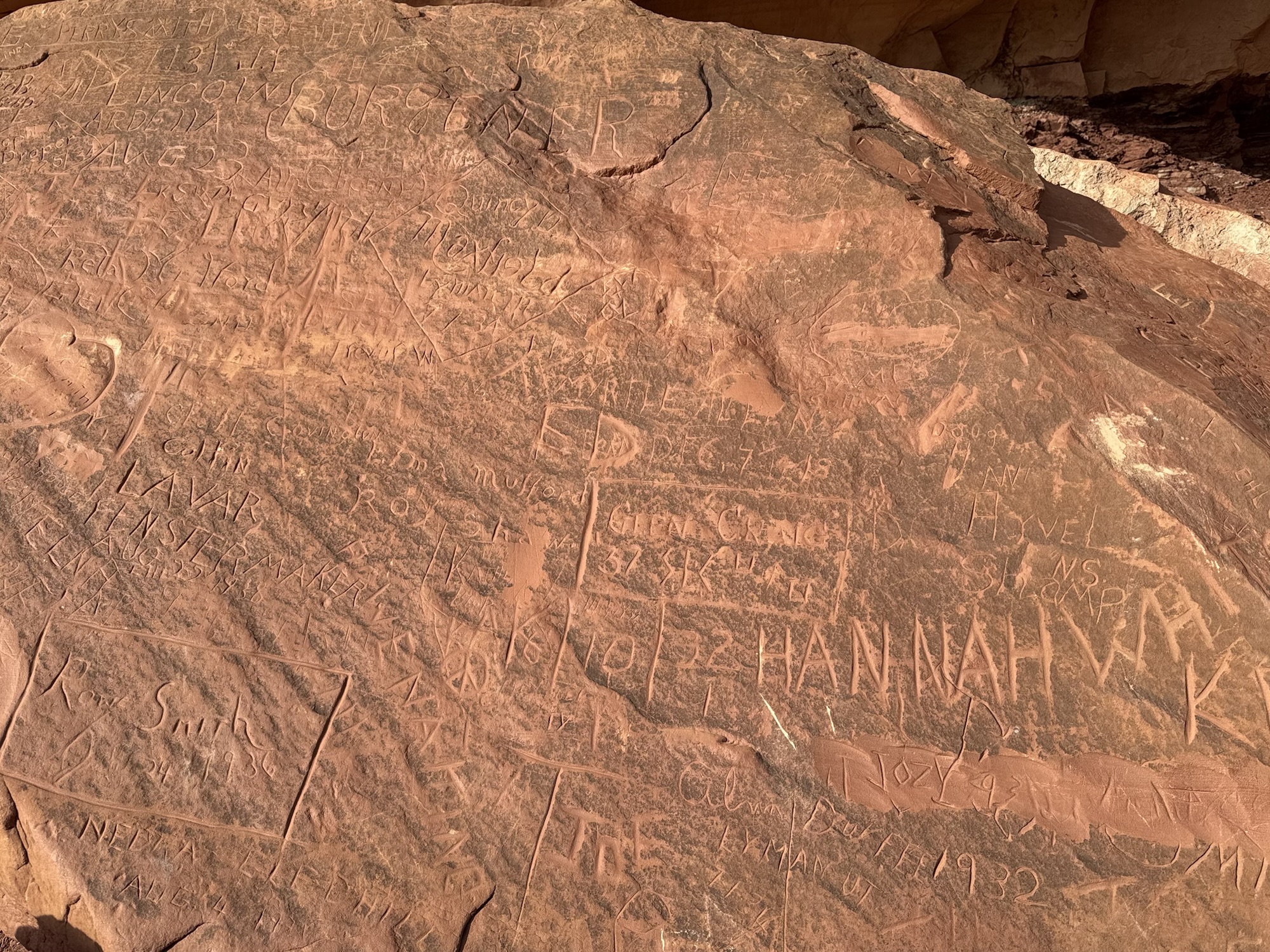
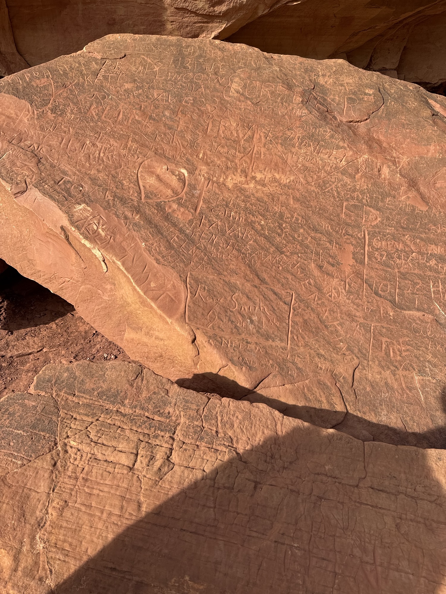
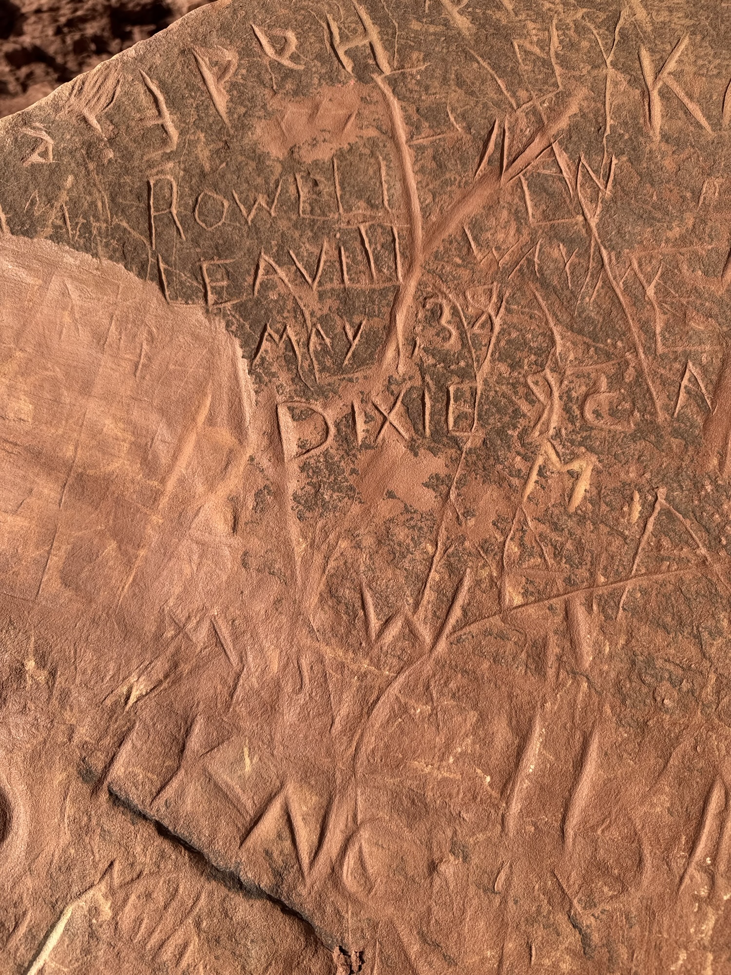
Right here near the base of the bridge, there’s a pile of redder sandstone boulders that people have been carving their names into for over 100 years. It reminds me of the carvings we saw on our hike at Kaaterskill Falls in New York, and some we saw last week on Dan’s Mountain in Western Maryland.


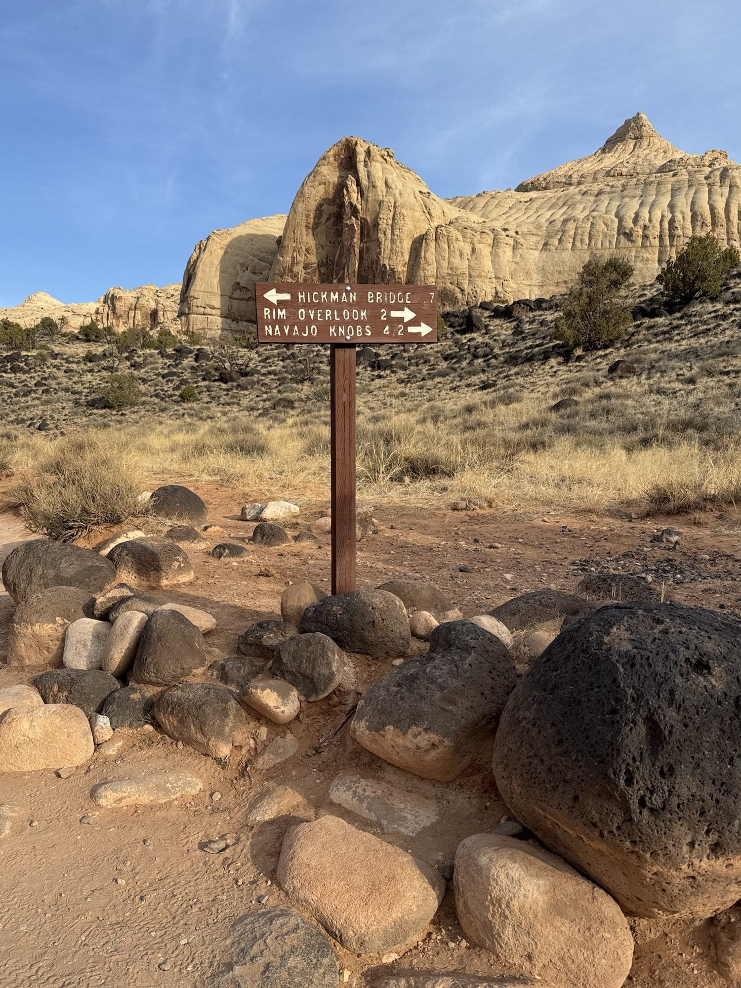
Hickman Bridge is one of the park’s iconic things that are always advertised on posters and included on so much of the Park’s souvenirs, so it’s always cool to be able to cross those things off the list when you visit.
The Civilian Conservation Corps built this trail in 1937 and named it after Joseph Hickman who worked in one of the local schoolhouses, then was elected to a State government position.


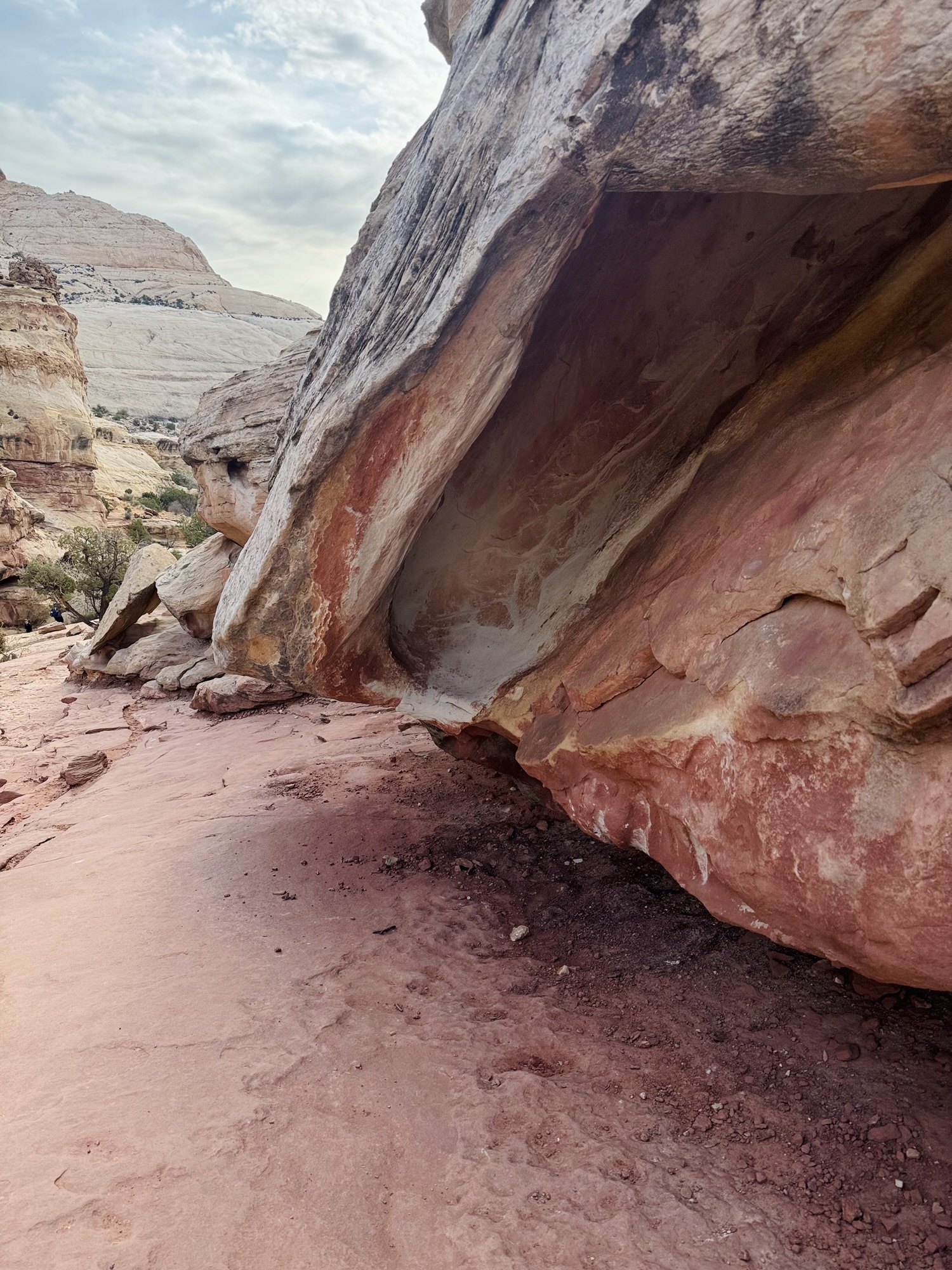
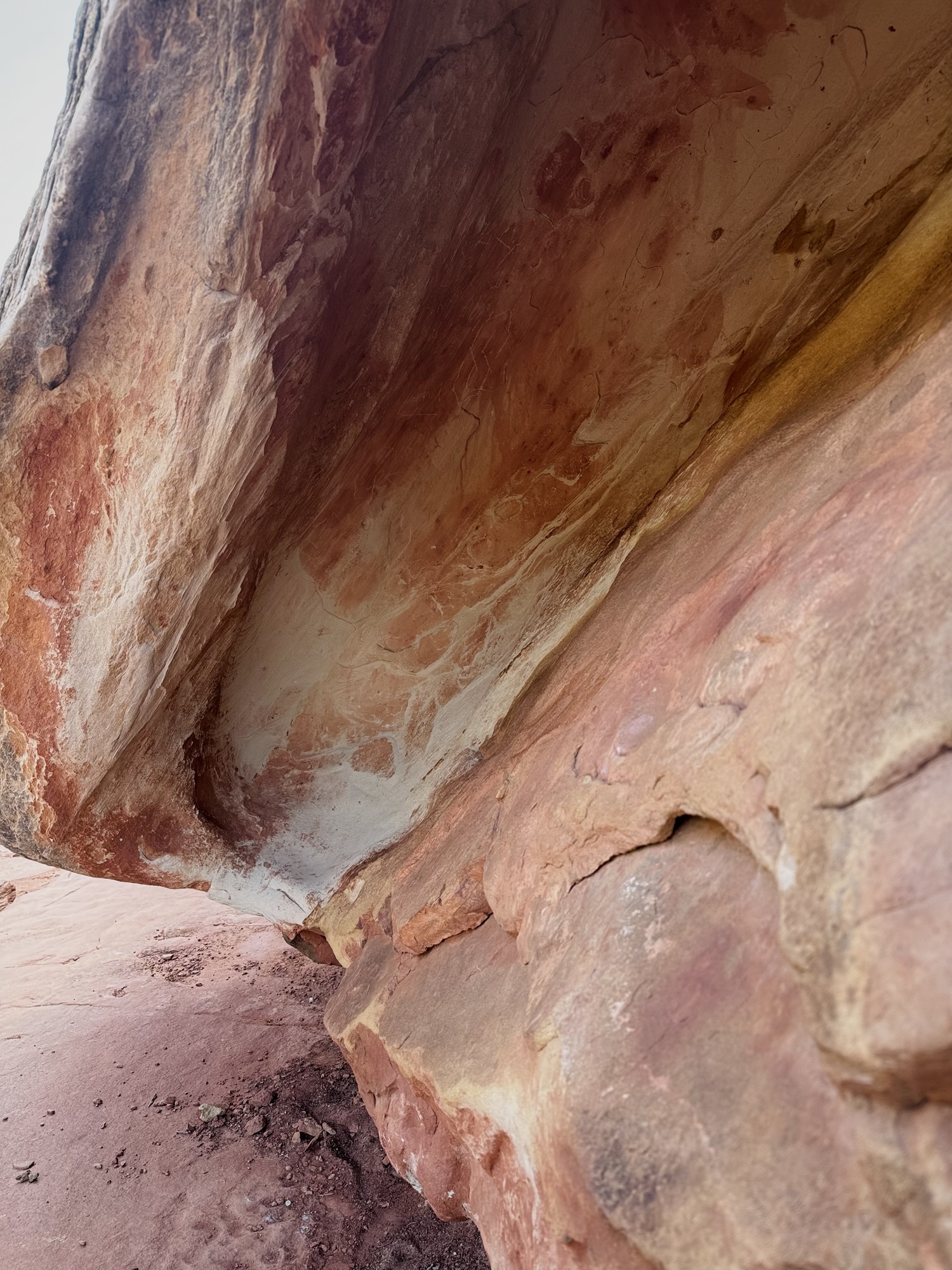
There’s such a wide variety of rocks here. While we were admiring and feeling all over this pink one below, a National Park Service volunteer geologist came up to us and started chatting. Then we ooh-ed and aah-ed and it together. It was such a cute moment. She said that she was a lifelong high school geology teacher and now that she’s retired, she spends time perusing Capitol Reef’s trails looking for people who wanna talk about rocks with her. That’s the dream.

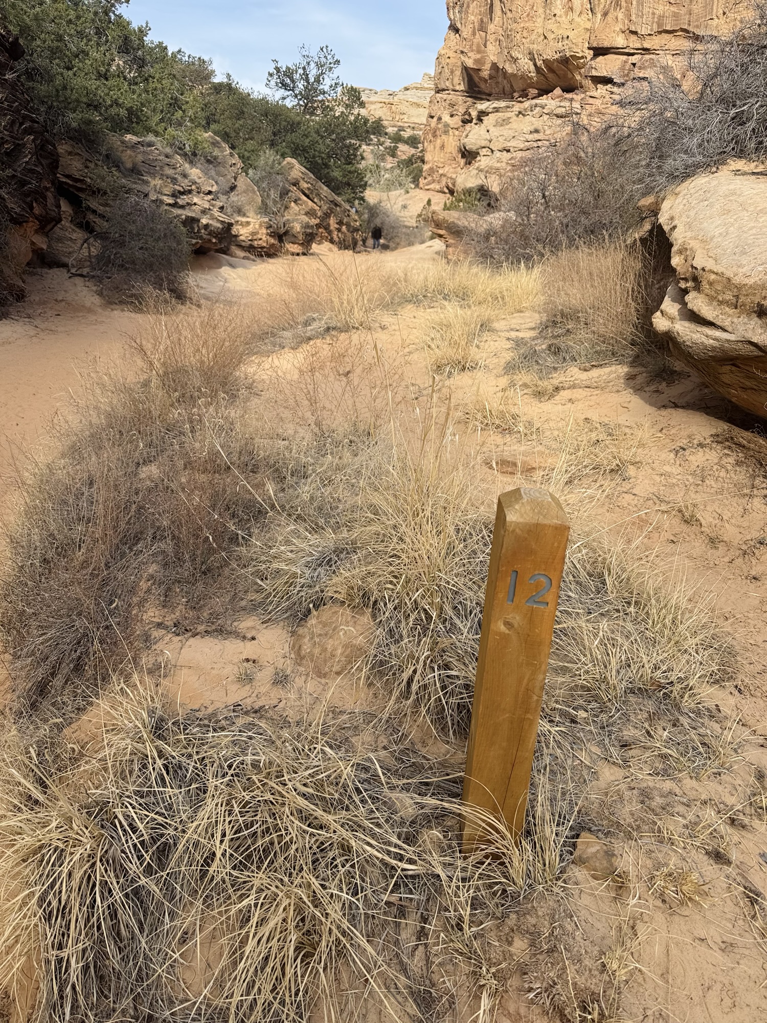
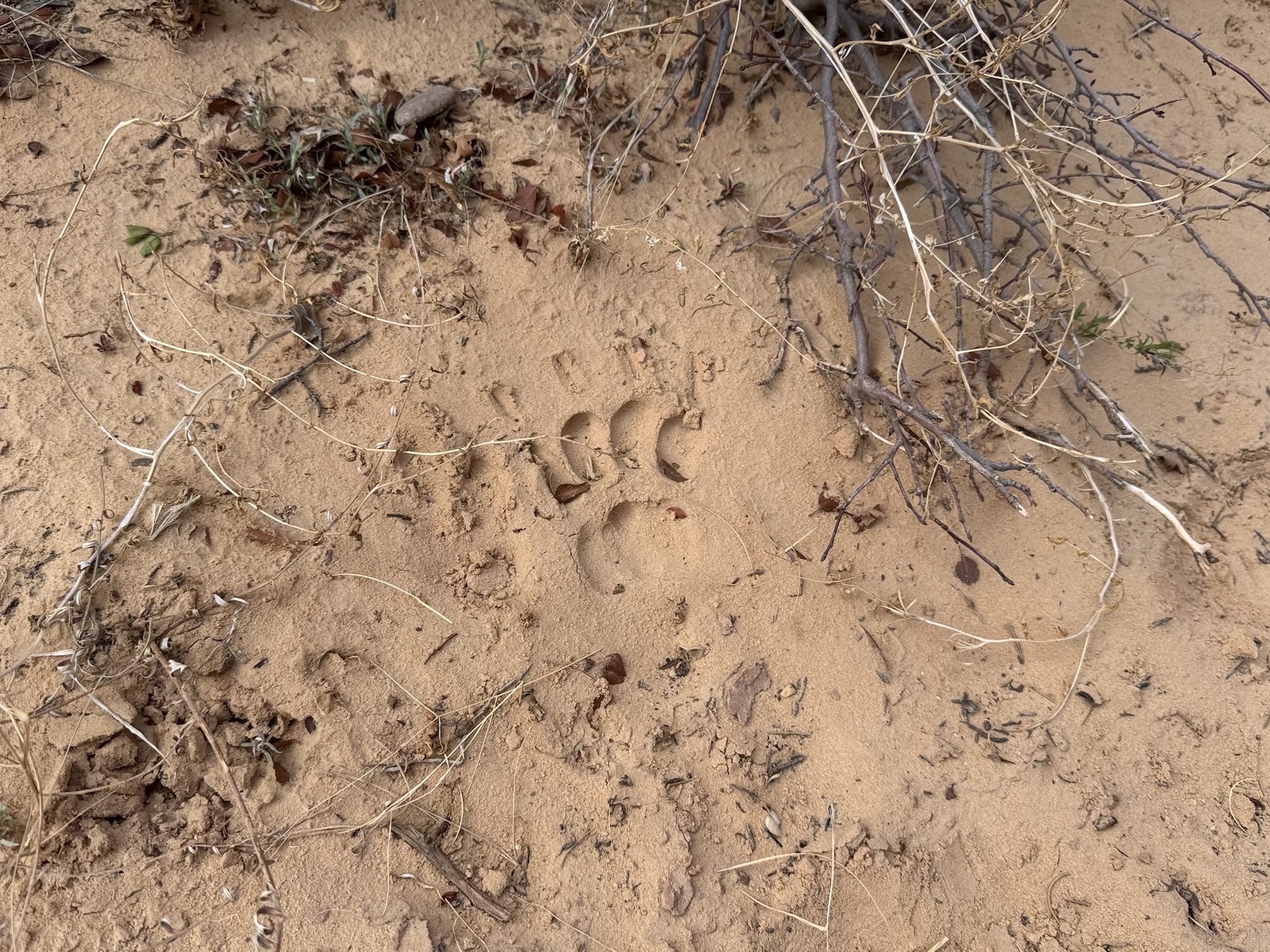
Then we found what I swear was a bear print! It was near stop #12 on the interpretive trail map. But when we show the volunteer in the visitor center, she said they absolutely do not have any bears whatsoever in the park. So maybe some kind of large cat..? I’d love to know.


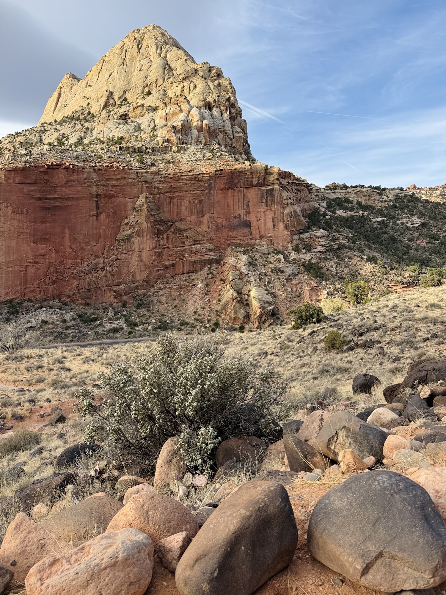
And by this time I was already feeling like this park was so underrated and gorgeous.
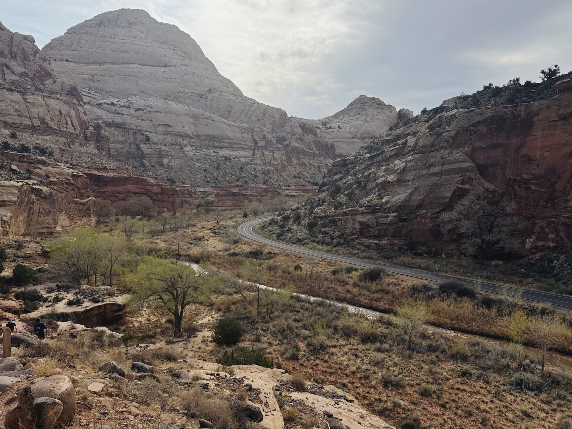
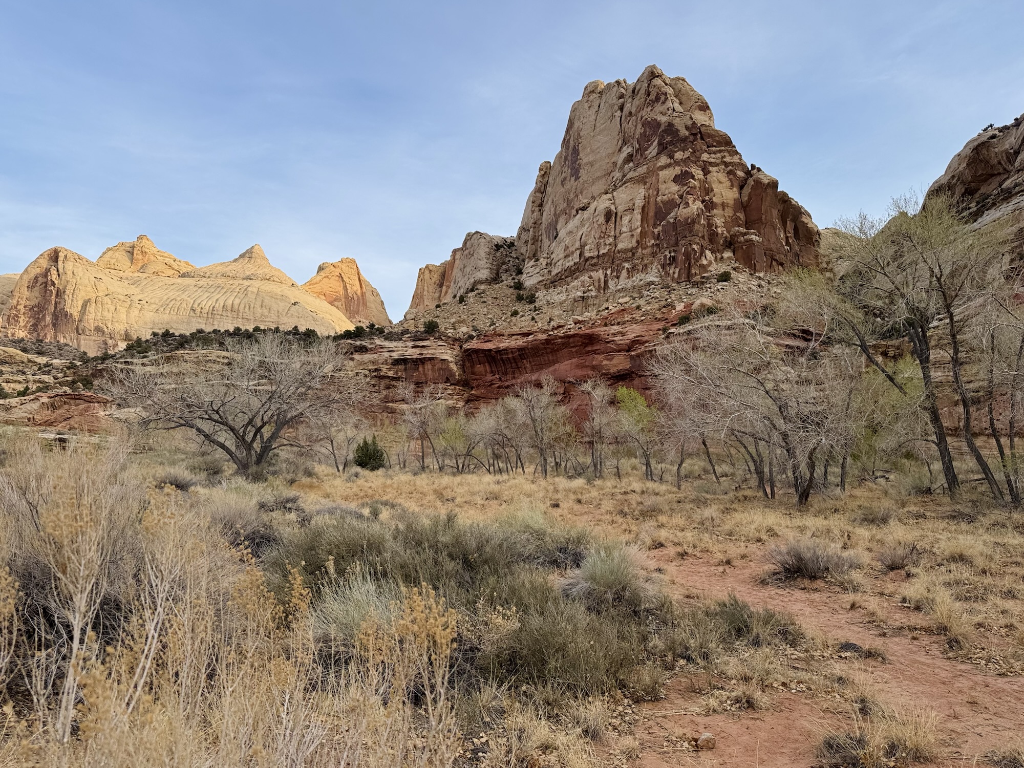
The Fremont River is what cuts through the park and under Hickman Bridge, and what shaped this landscape completely with it’s wild floods.
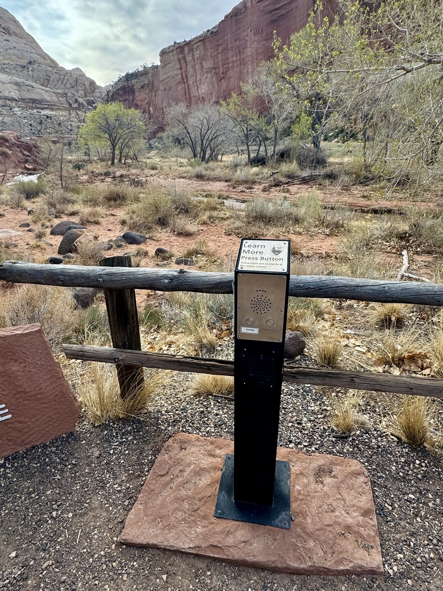


One of the cool things that Capitol Reef had that I’ve never seen at any other park are these posts where you press a button and a voice starts talking to you about what you’re looking at. So while we stood here to soak in the view from the parking lot after our hike, we listened and learned so much more about it.
“Capitol Reef National Park is a geologic wonder that reveals changes to the Earth. The park was proclaimed a National Monument on August 2, 1937 by Franklin Delano Roosevelt to protect “narrow canyons displaying evidence of ancient sand dune deposits of unusual scientific value.” It was established as a National Park on December 18, 1971 by an Act of Congress.
“Early European travelers referred to this area as ‘Capitol Reef.’ A large Navajo Sandstone dome in the distance, called Capitol Dome, reminded them of the early U.S. Capitol Building and the overall terrain served as a barrier to travel, much like a reef in the ocean. The name remains, but the landscape has been changing.
“The geologic story of Capitol Reef can be summarized in three major events: depositions, uplift, and erosion with change as the only constant.
“Today the park is a high desert, but past environments evolved over time from oceans and river river systems, to arid deserts, swamps, and coastlines all due to plate tectonics slowly moving the land from near the Equator to its present day latitude of 38 degrees north of the Equator. The result is the deposition of 19 different layers of rock over a 280 million year time-frame in the Earth’s 4.6 billion year story.
“65 million years ago, an ancient, buried fault line was reactivated and uplifted one side of the rock layers to over 7000 feet (2130 meters). The pliable layers over the fault folded and created a monocline. Weathering from water and wind has eroded away much of the rock, leaving cliffs, buttes, canyons, arches, and domes. The landscape will continue to change. Every flash flood and rock fall continue to shape and erode Capitol Reef. One day what we know as Capitol Reef will be gone…”

You know I gotta shout out the NPS-managed toilet. This one was actually stalls with flush and sinks, hallelujah.

Capitol Reef National Park via National Park Service:
https://www.nps.gov/care/index.htm
Hickman Bridge trail via AllTrails:
https://www.alltrails.com/trail/us/utah/hickman-bridge-trail
More about the history of Hickman Bridge:
https://en.wikipedia.org/wiki/Hickman_Natural_Bridge
More about the black boulders in Capitol Reef:
https://www.nps.gov/care/learn/nature/blackboulders.htm
Capitol Reef trail guide via NPS:
https://www.nps.gov/care/planyourvisit/trailguide.htm


Leave a comment