

And it’s really, really cool.
Wupatki National Monument was the second indigenous “American” site that we visited near Flagstaff, AZ. We’d visited Walnut Canyon a few years ago and were in awe of it, so we were pretty psyched to return to the area. Wupatki NM has a few different areas that you can explore along the scenic drive that it shares with Sunset Crater Volcano National Monument.
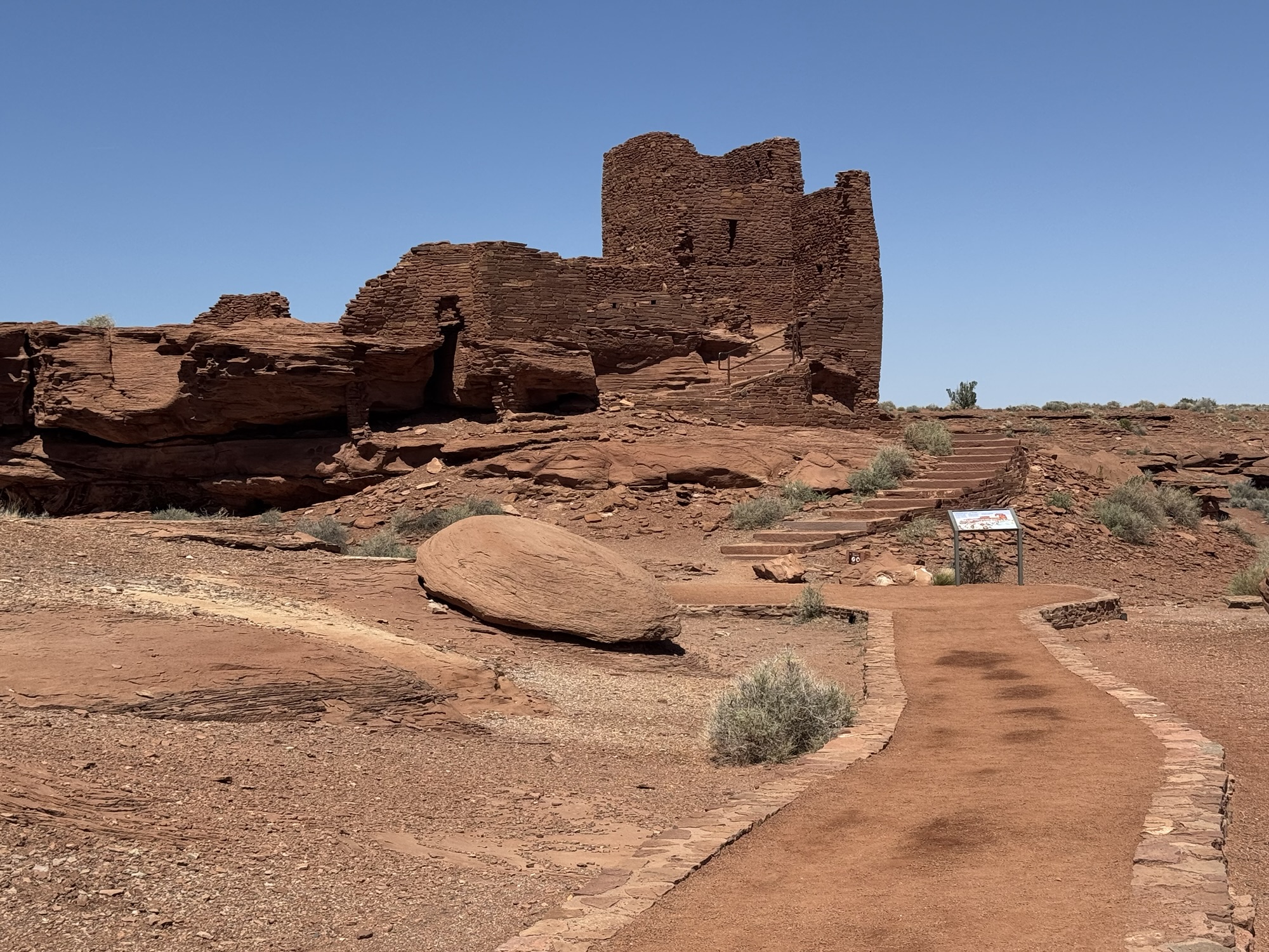
The most recognizable from social media probably being the humongous Wupatki Pueblo.
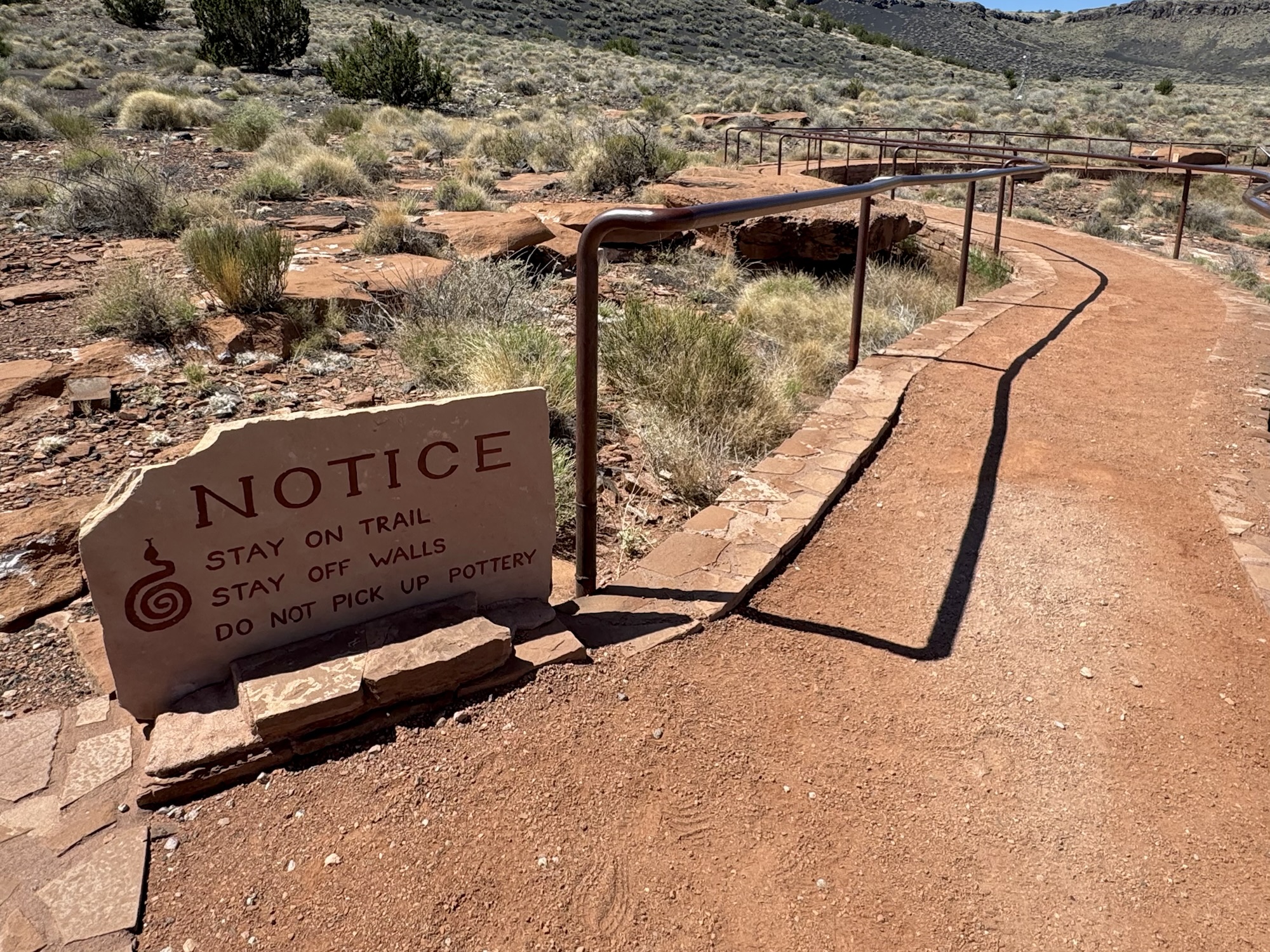
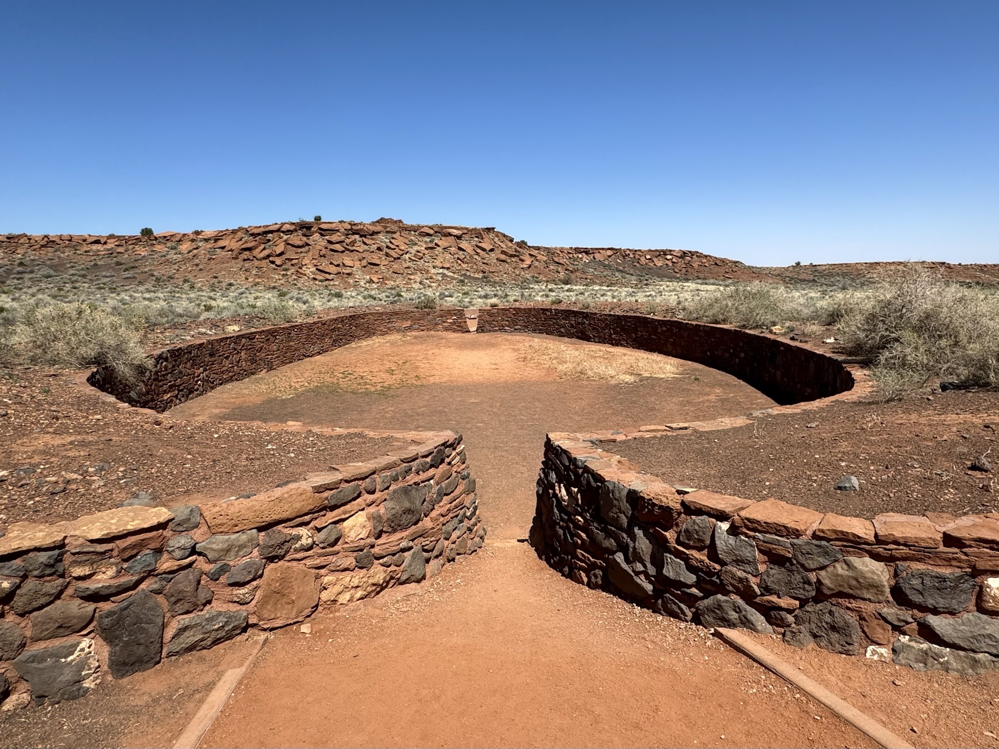
At the Wupatki Pueblo site, there’s a gigantic apartment-mansion-type structure, and down the hill from there is a ball playing court. The blowhole is right next door, and it is literally a place where air naturally blows in or out of the Earth.
I’m really glad we saved the Wupatki Pueblo (which is behind the visitor center) for the end of the visit because it would have outshone everything had we done it in reverse.
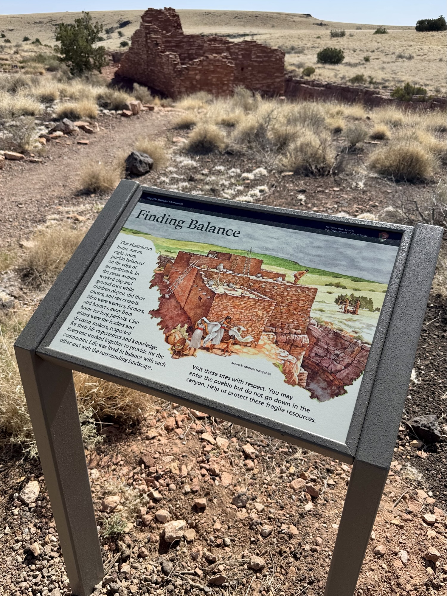
If you come from the northwestern entrance of the Monument like we did, you’ll come across Lomaki and Box Canyon Pueblos first.
Lomaki & Box Canyon Pueblos
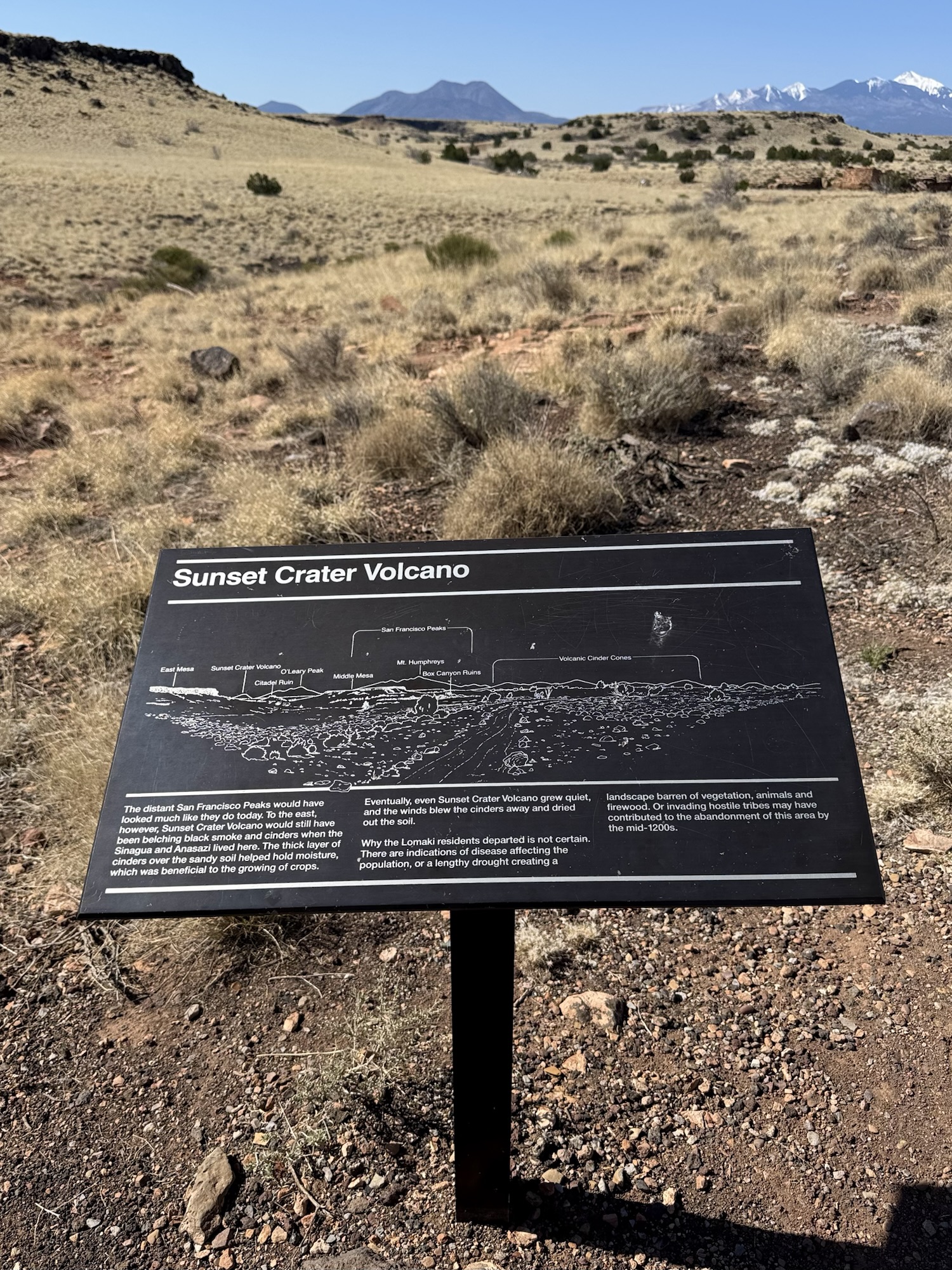
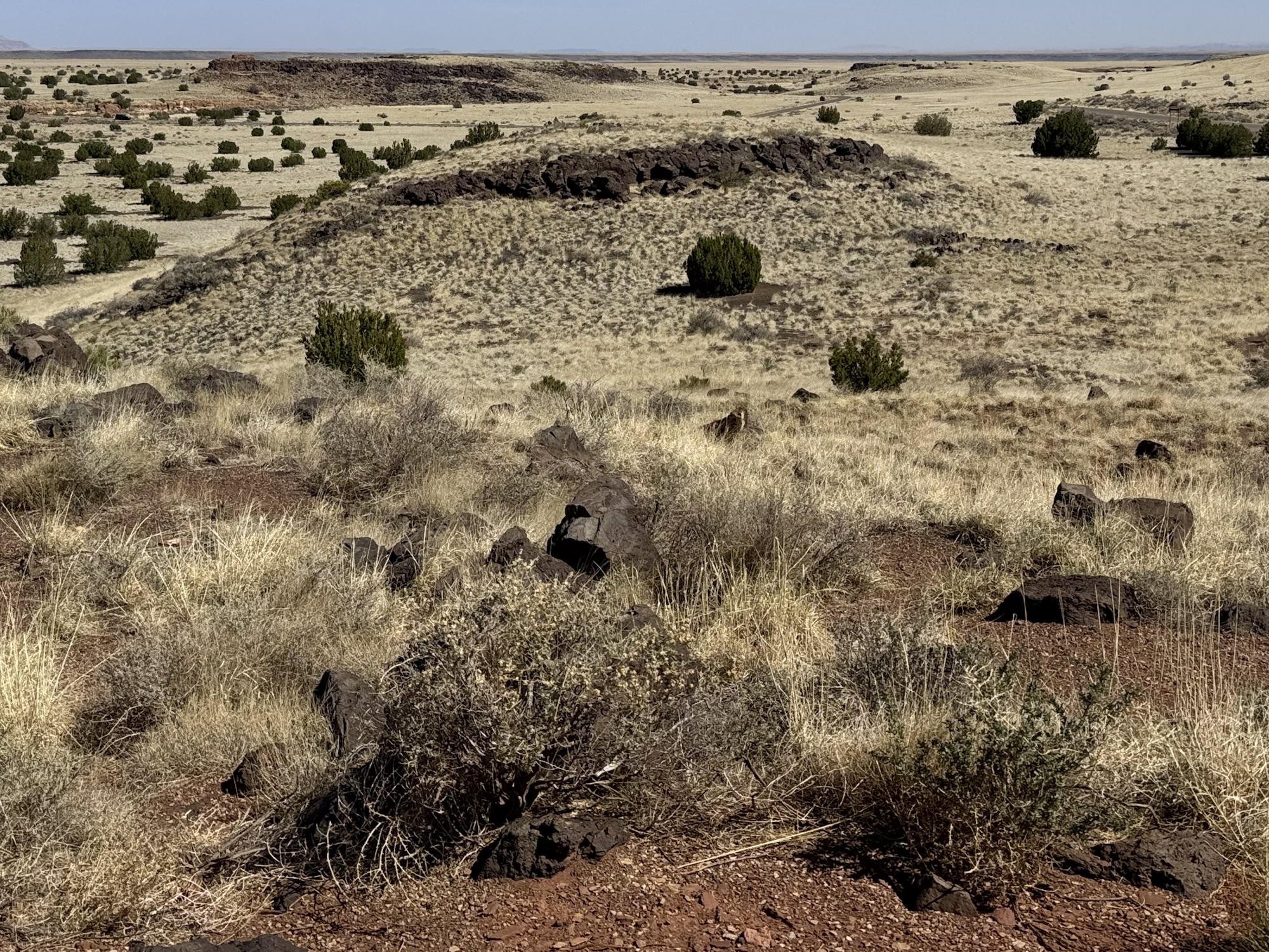
“The landscape surrounding you experienced the end of an ice age 11,000 years ago. The climate became dryer and warmer about 7,000 years ago. Natural fired routinely spread, sustaining healthy grasslands and habitat for wildlife that thrives in open range.“


“People have also used and changed this landscape through time. From many thousands of years ago to the present, hunters once took down mammoths, Hisatsinom (ancestral Hopi) farmers planted crops and constructed homes. Navajo shepherds grazed sheep and built homes, and modern Euro-American ranchers grazed cattle.”
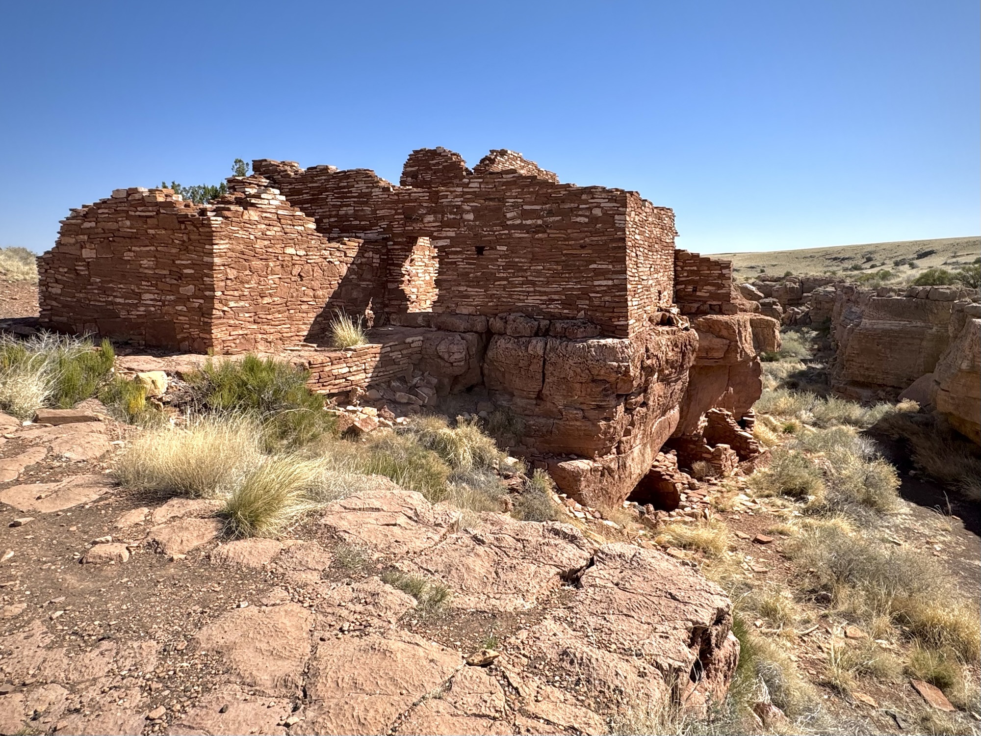
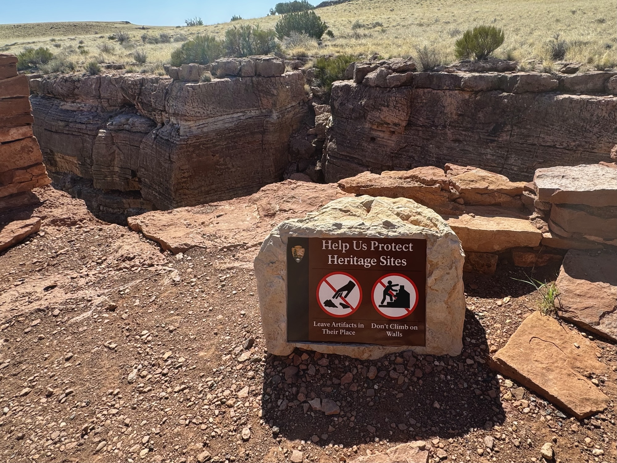
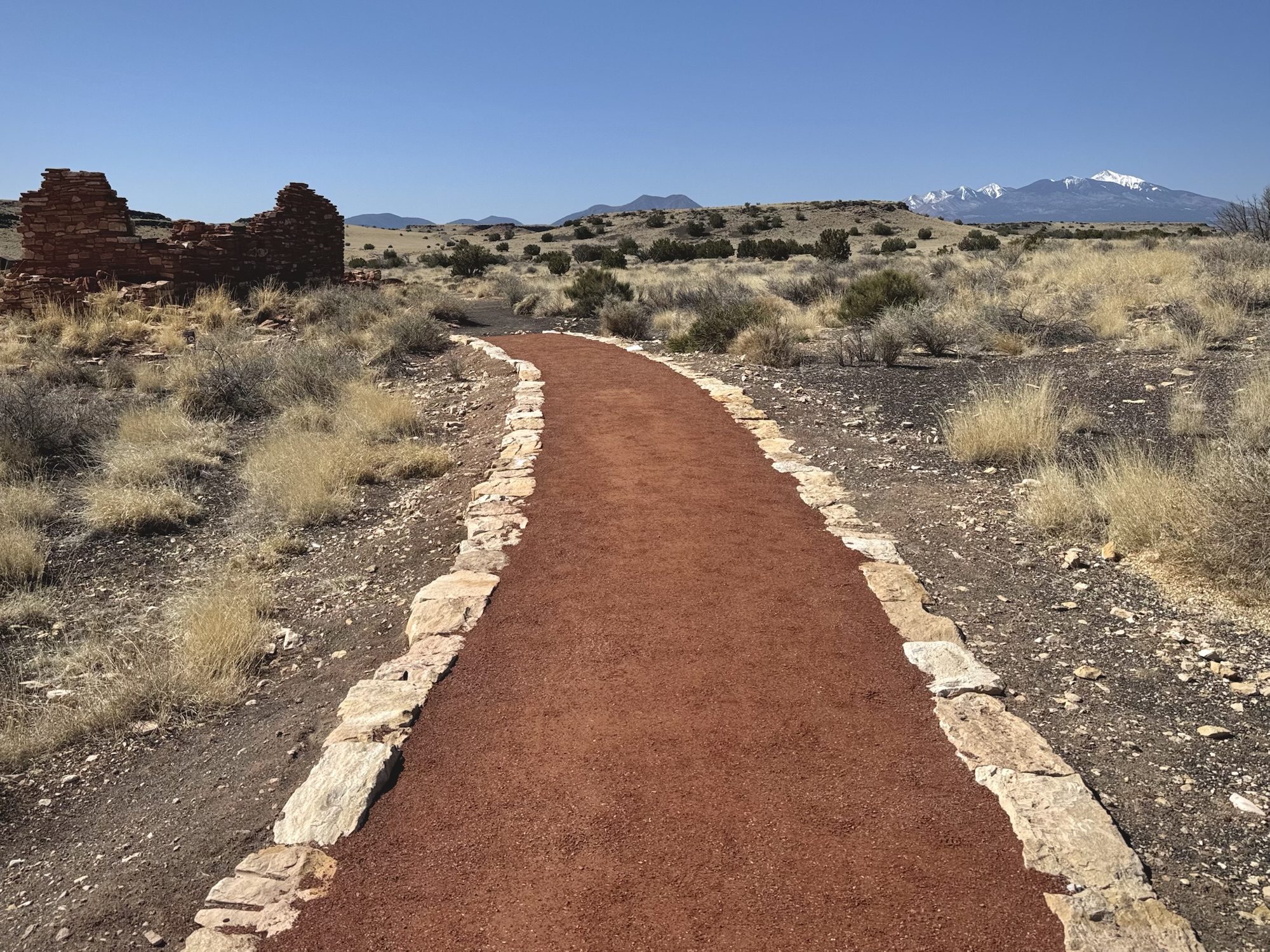
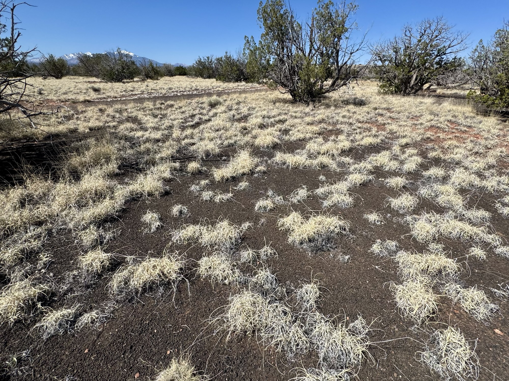
“As you walk the Lomaki Pueblo trail, you will see 900-year-old structures balanced on the rims of an ancient earthcrack, volcanic peaks on the horizon from which lava and cinders shaped the landscape, and surrounding grassland which has survived various uses and changes.”

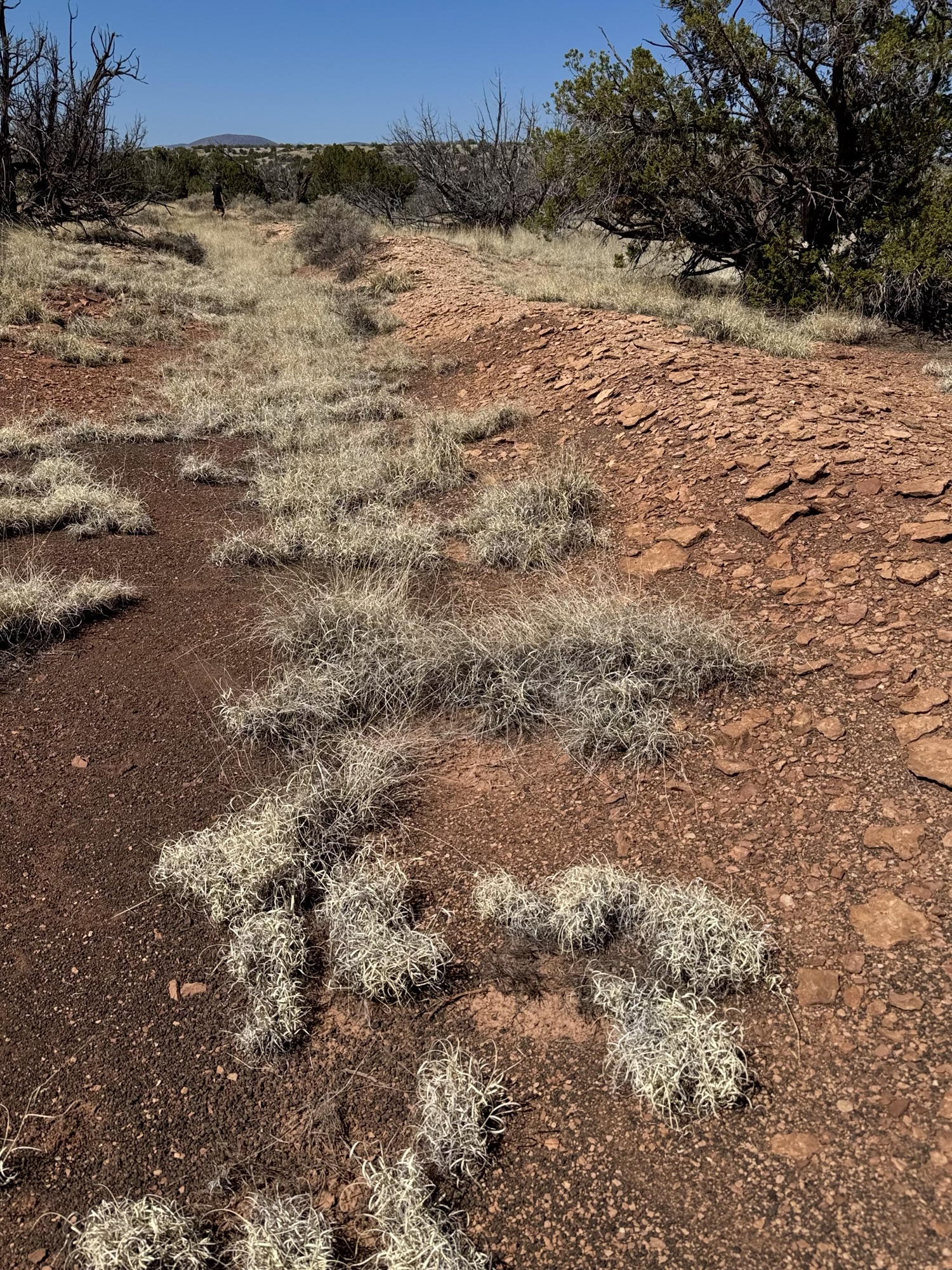
The Lomaki Pueblo trail is a quick 0.65-ish found trip along a red sandy-ish gravely paved trail lined in rocks. You’re lead to both structures and have the ability to explore within them.
It’s amazing to think of them looking at Sunset Crater Volcano and the San Francisco Peaks on the horizon just like we can.

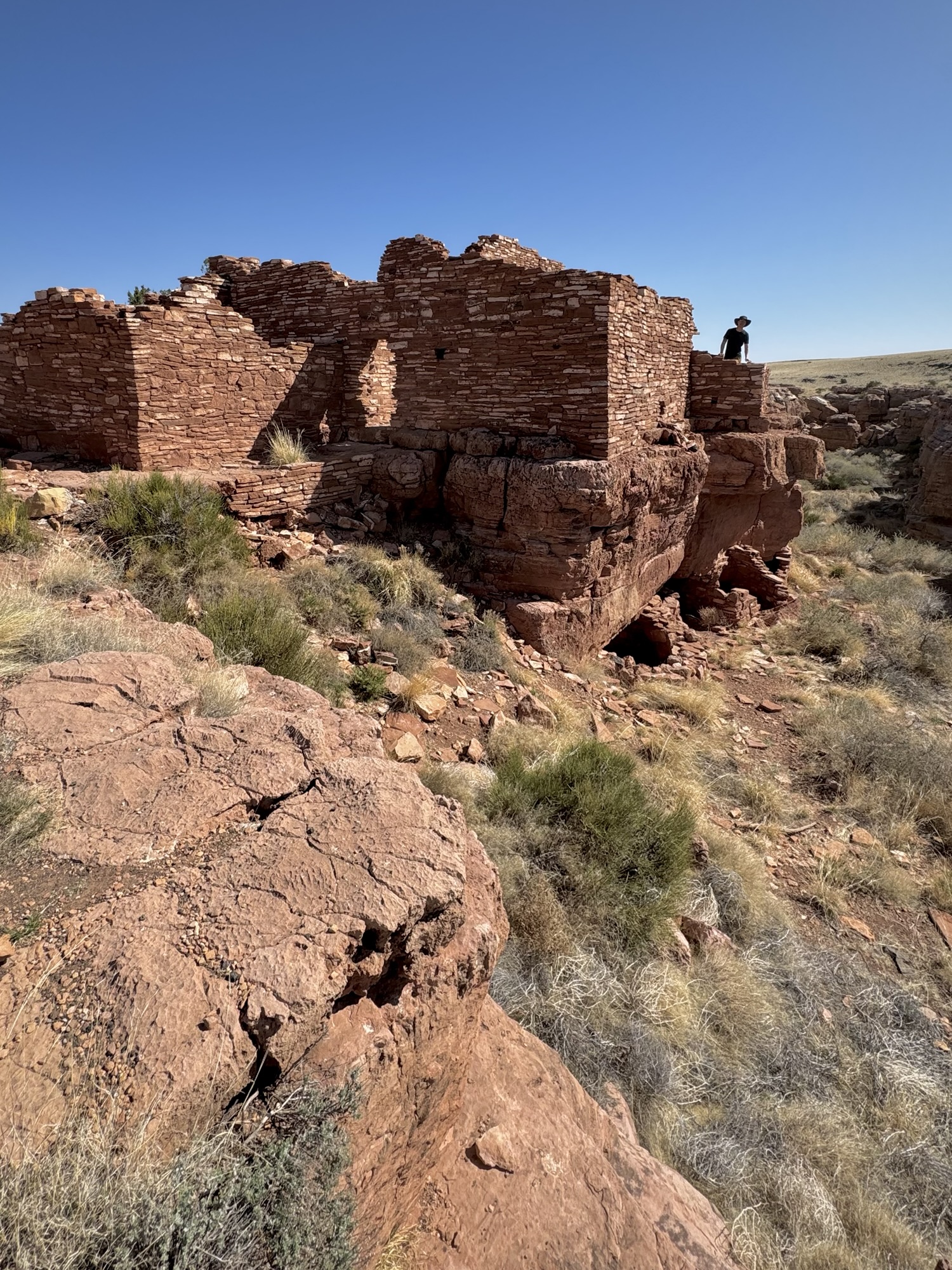

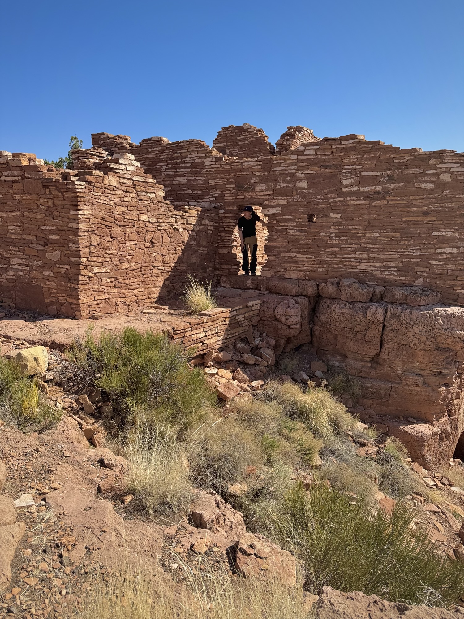
I loved being able to use their actual doorways to go in and out, ducking all along the way and imagining what this place must have been like and felt like for them. Even though this was our first stop in the Monument, we were already sold.
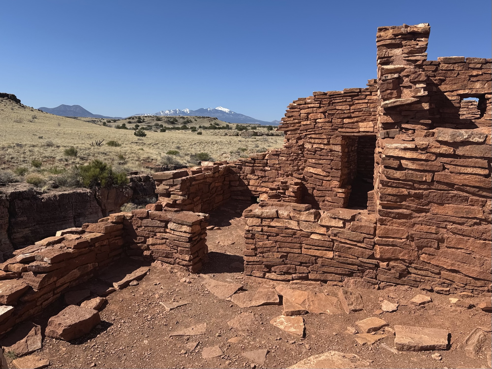
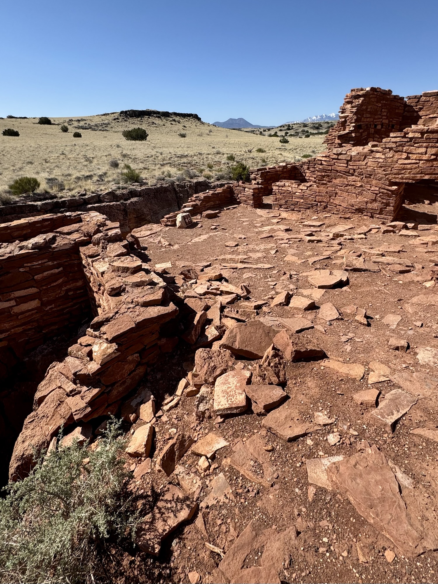
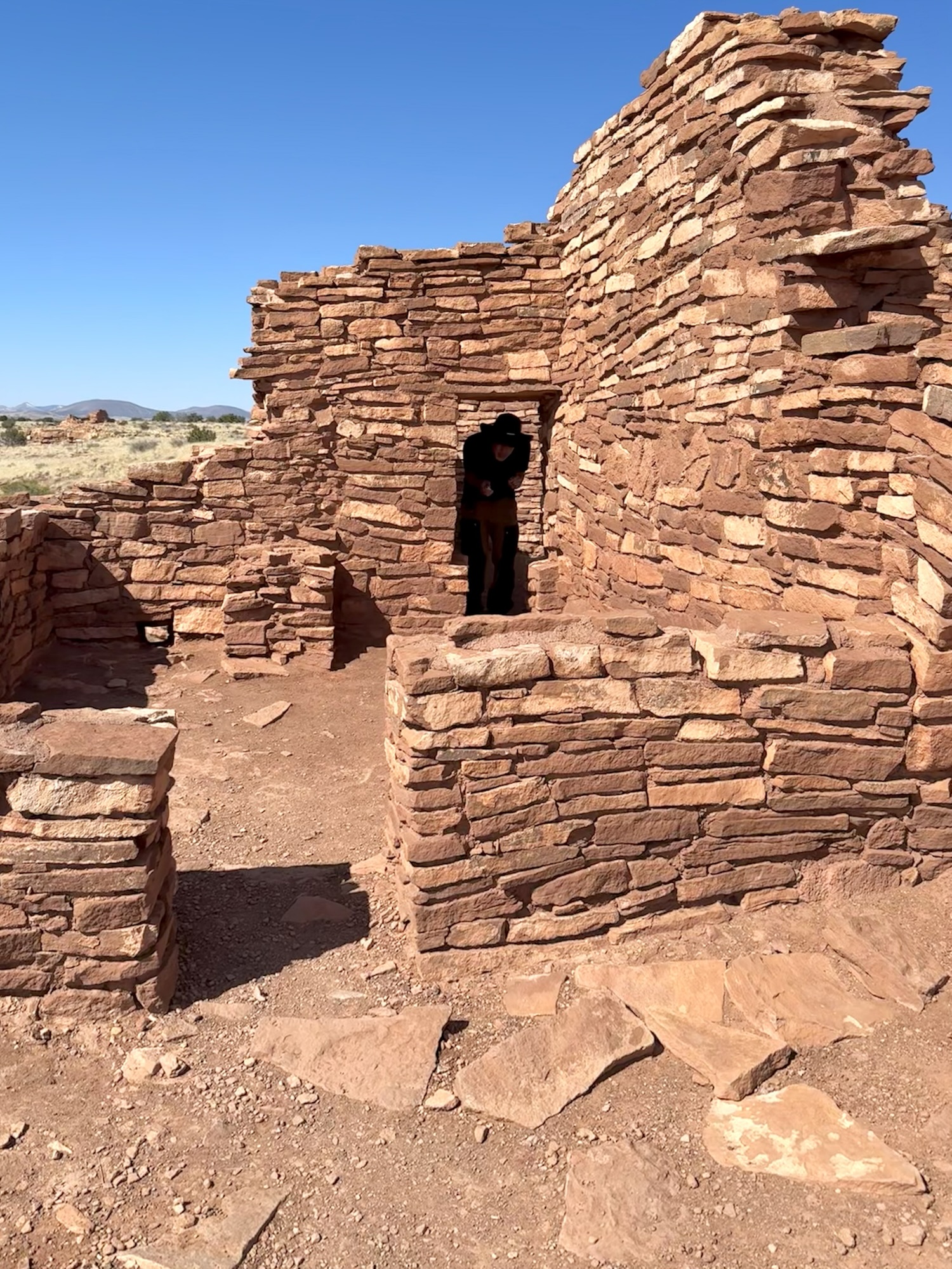
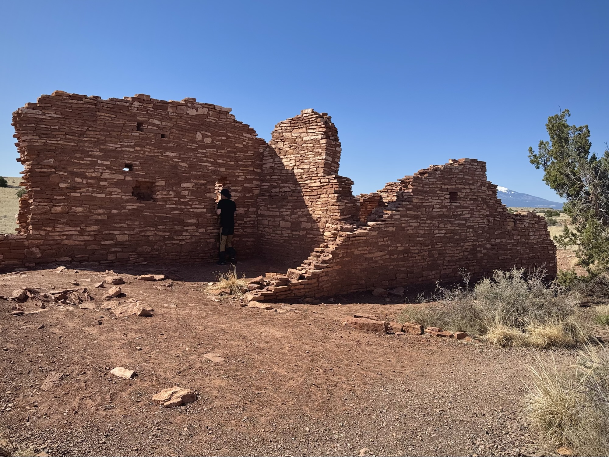
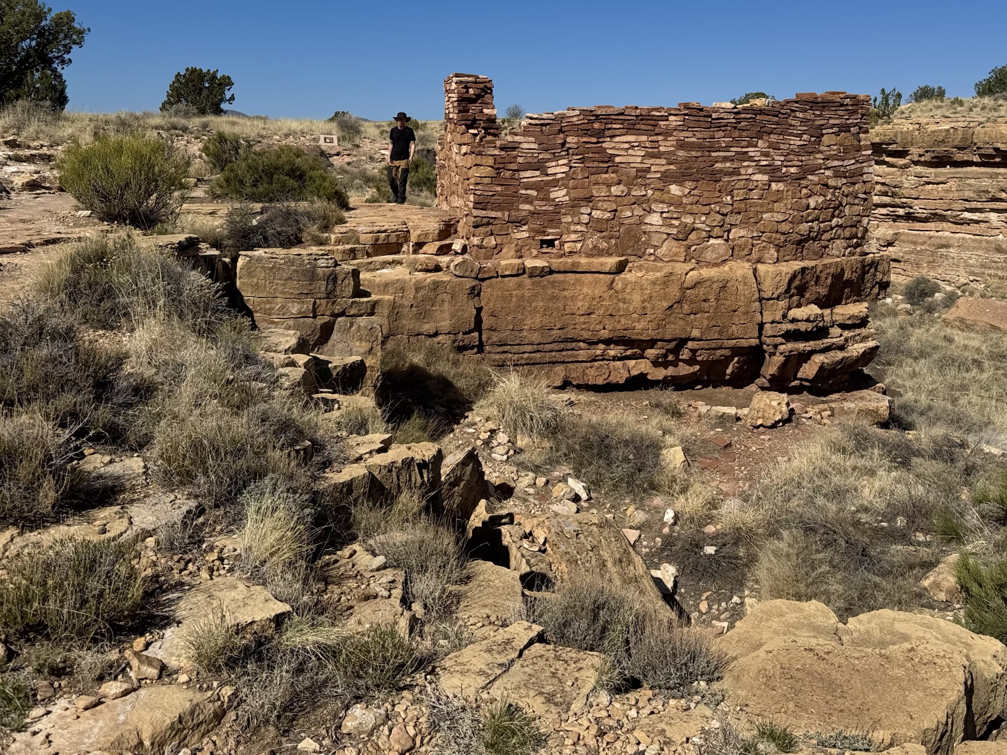
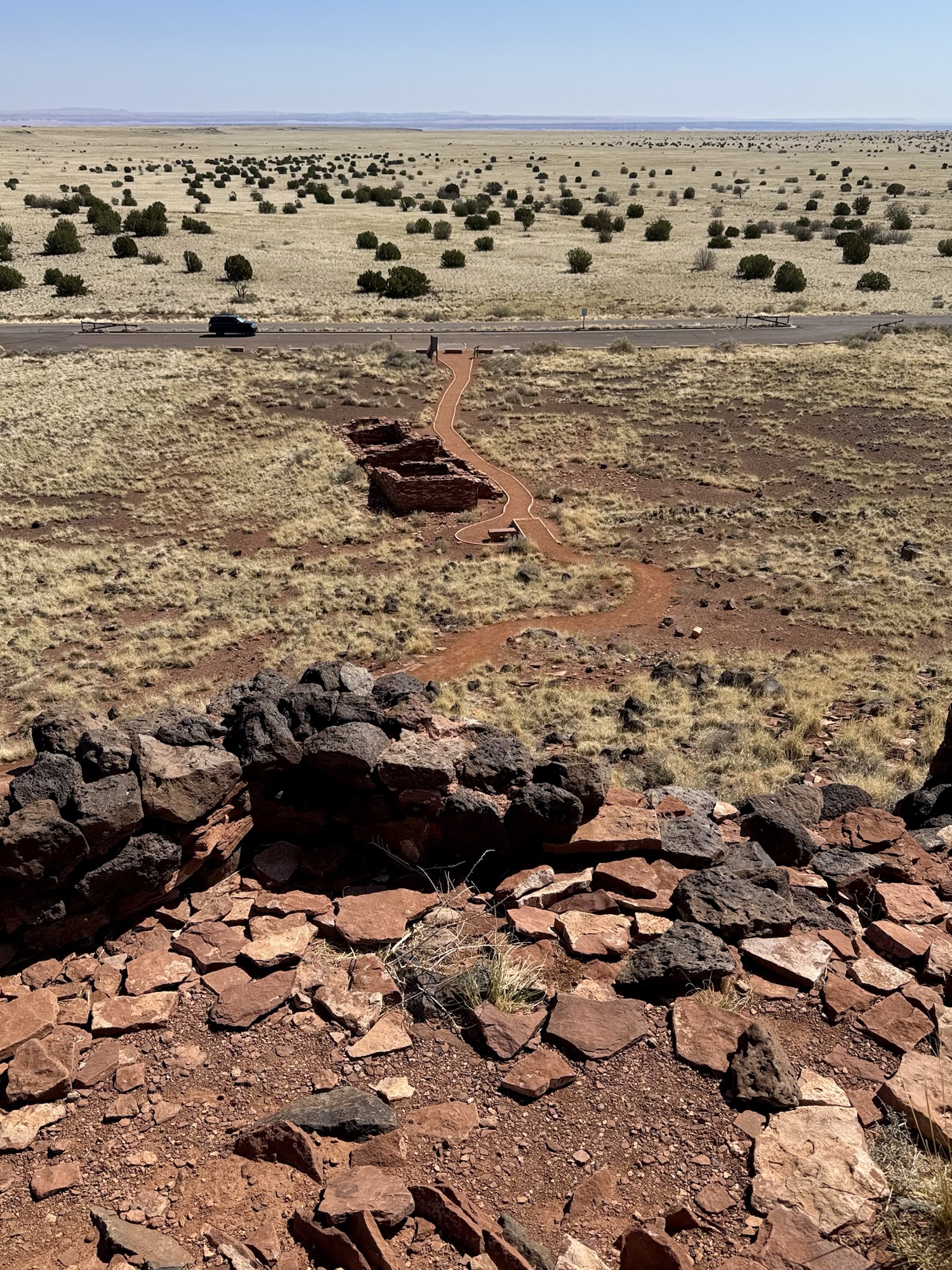
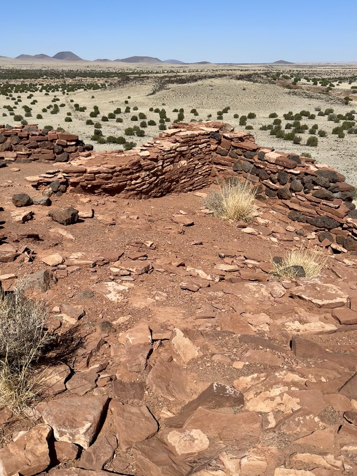
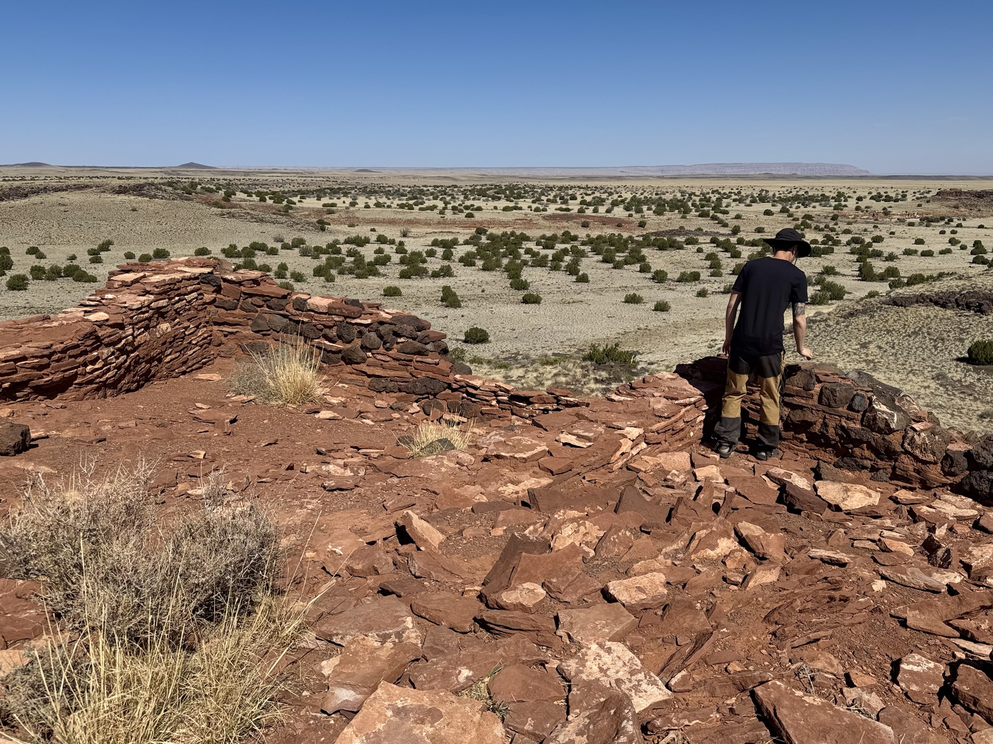
All of these photos are of Lomaki Pueblo, in Hopi meaning “beautiful house.” And man… is it. It has nine rooms and is made out of sandstone with limestone, just like the other sites in the area. They think it could’ve been covered by plaster or something else, but of course nothing like that can survive over time.
Lomaki Pueblo is at the end of the trail, then we opted to turn around and visit Box Canyon. You can also do reverse order if you want, but we were (honestly) trying desperately to dodge the other visitors that were there. Iykyk. 🙂

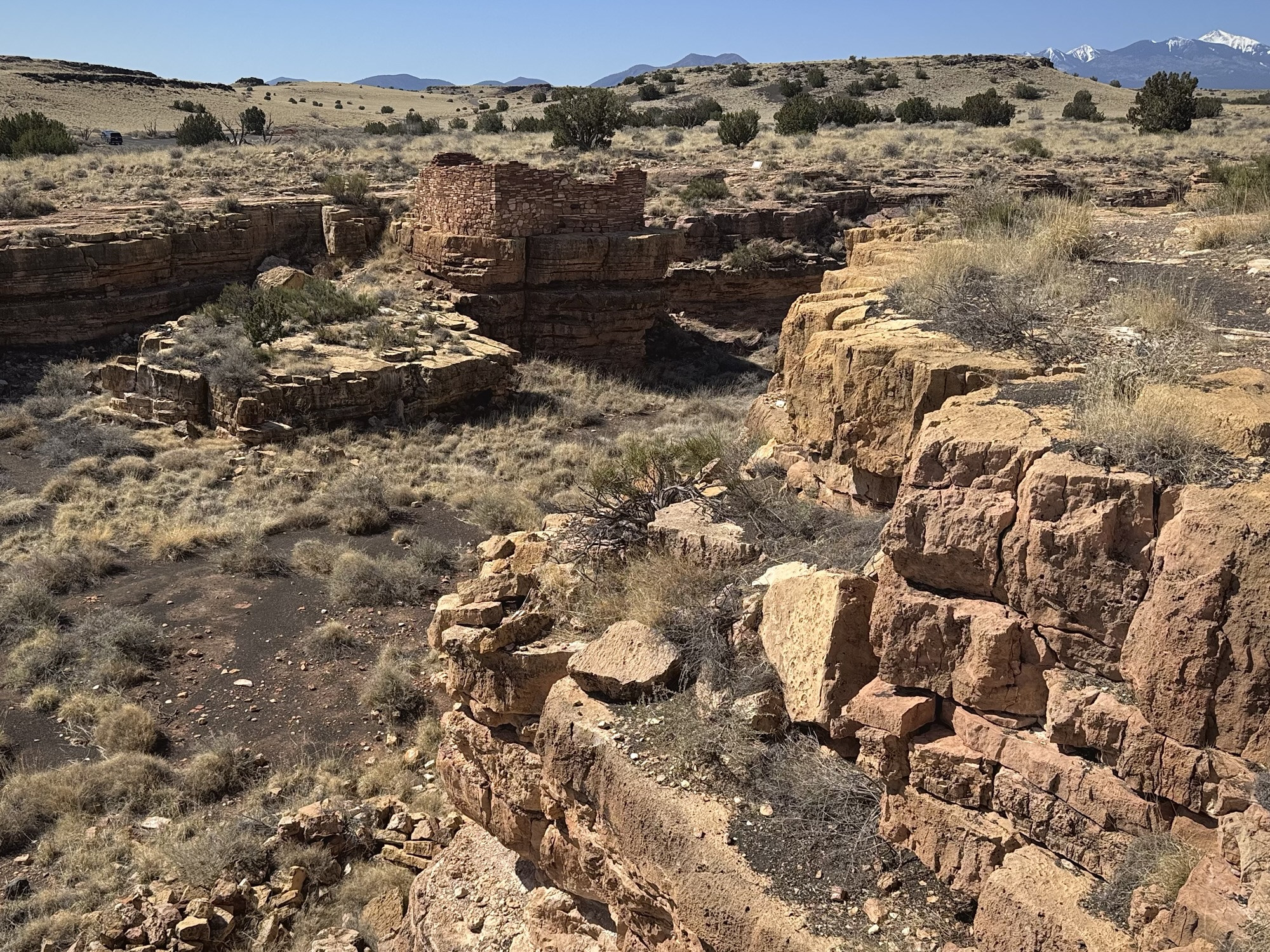

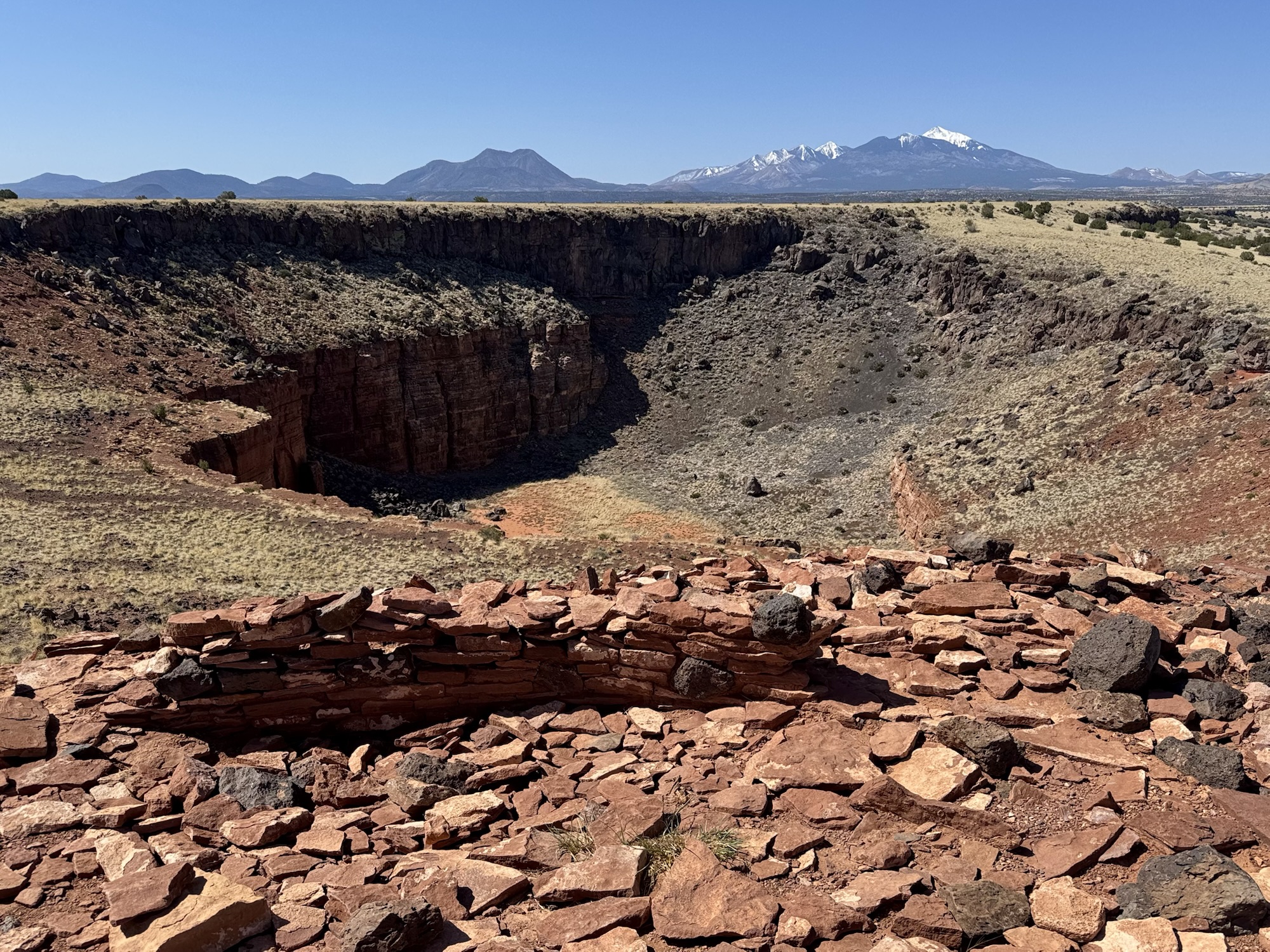
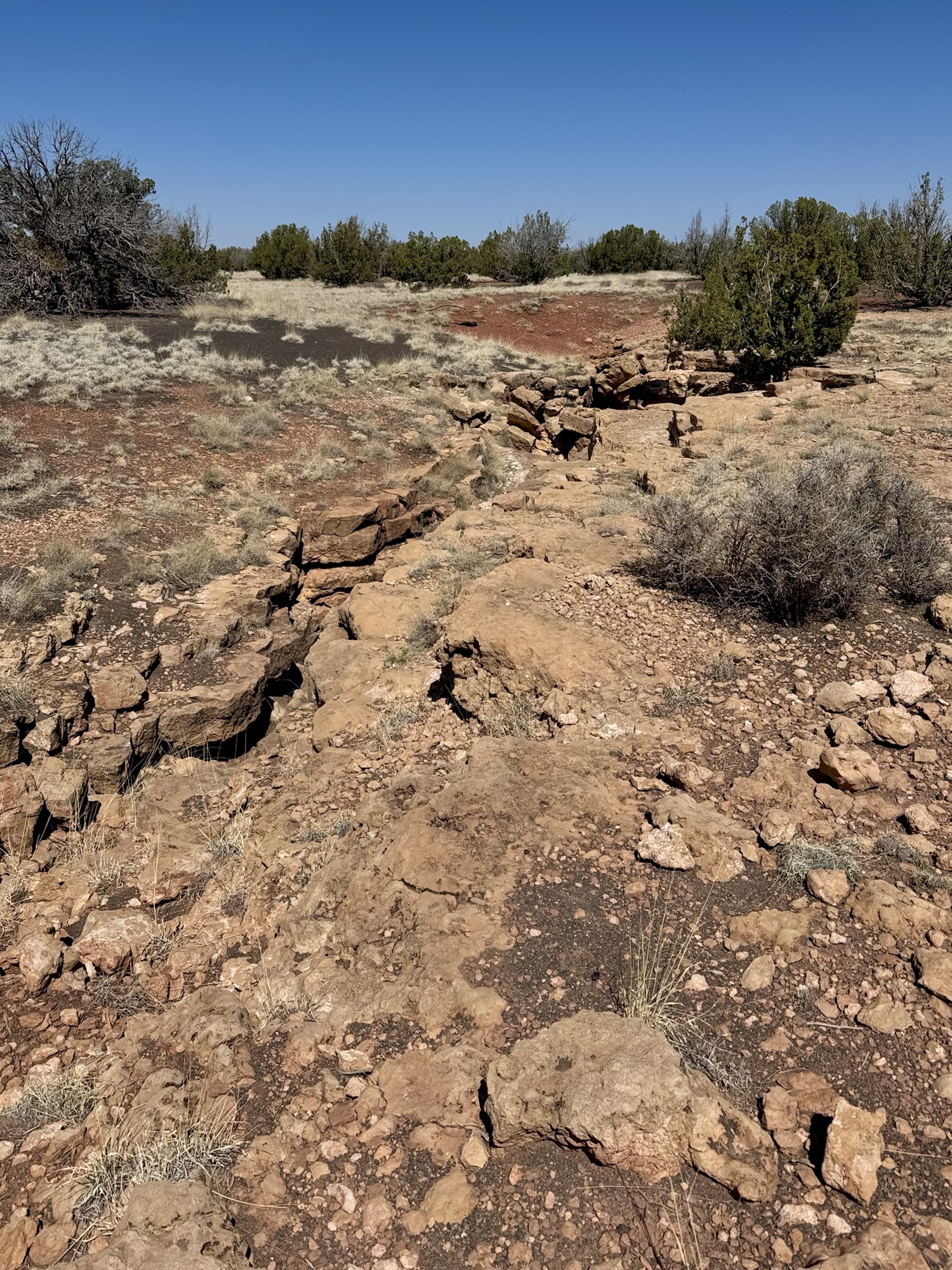
Box Canyon Pueblo is smaller and is perched on the edge of the giant earthcrack that defines this area. You can walk up to it, but there’s no way to access the inside – you don’t need to anyway, it’s all very visible.
Nalakihu & Citadel Pueblos
Citadel is so cool! It’s so majestic to walk up to, like a literal fortress. On your way up the sidewalk, you pass way-smaller Nalakihu Pueblo. You can peer over the side of Nalakihu and see some of their ancient grinding stones. They’d actually used Nalakihu Pueblo as a contact station in the 1940’s or 1950’s (?) and had constructed a roof on it’s walls and everything, casually just working inside of it.


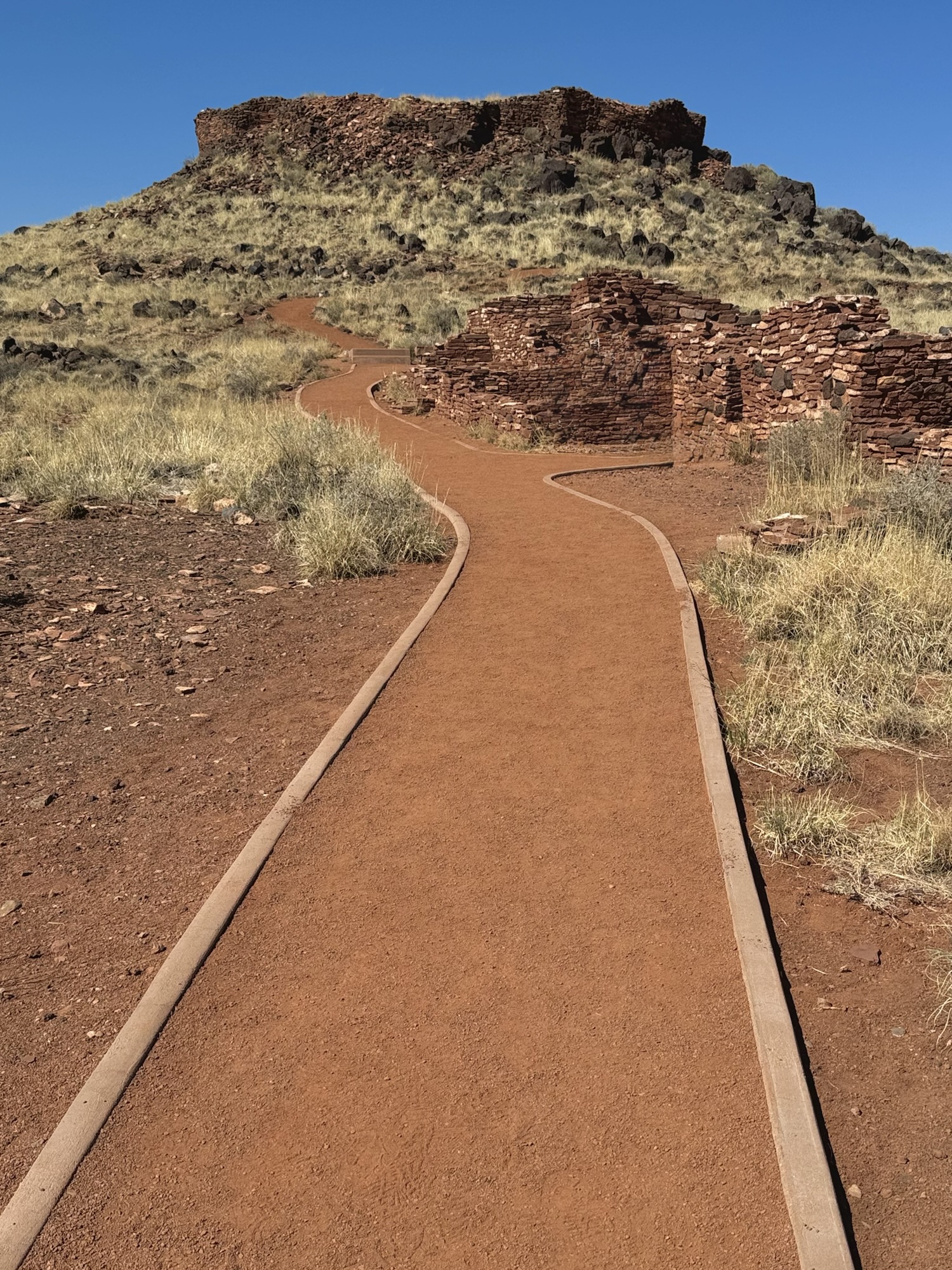

The straight up-hill walk in the unshaded blazing sun is allll worth it once you get to the top and admire how great of a view point this place gave them. Adjacent to the pueblo is a super huge sink hole that is still sinking, causing earth cracks, canyons, and other blowholes to pop up around the area.

Nothing’s complete without a random geocache
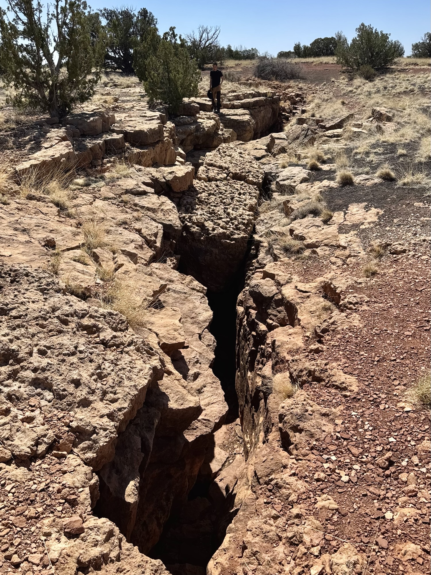
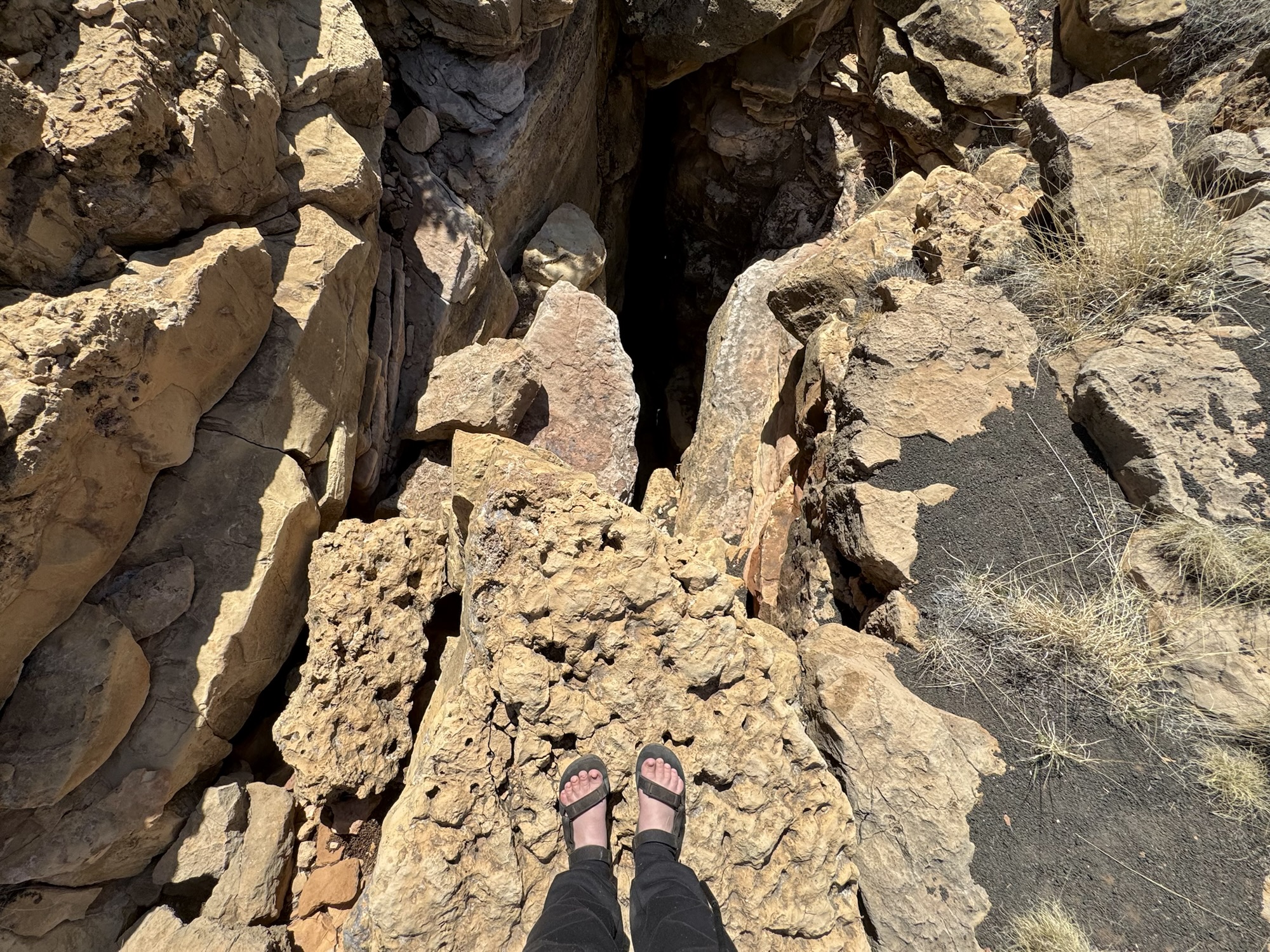
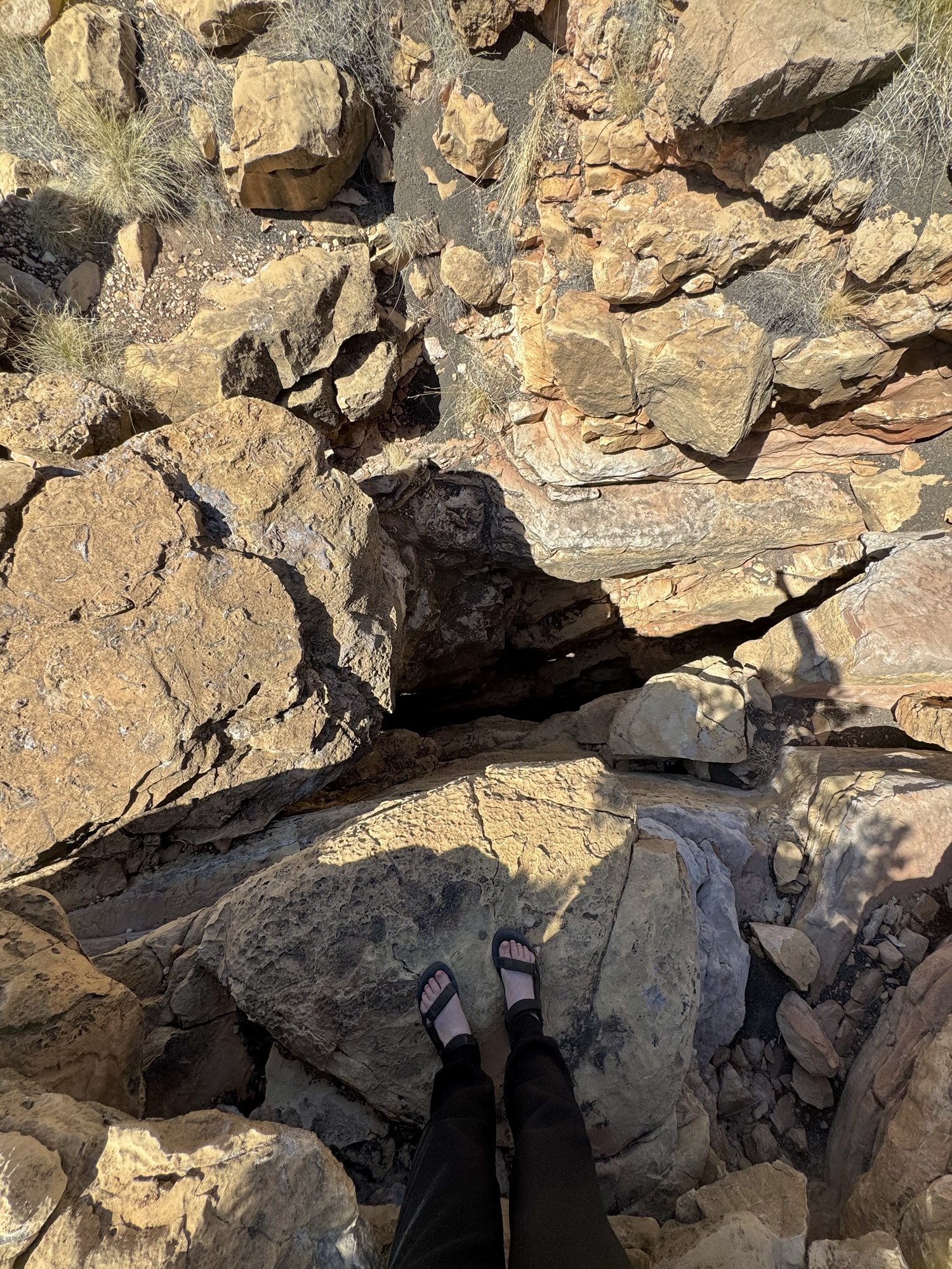
On the way out of Citadel and toward the visitor center, there’s a random gravel-ish sideroad that leads to an open area covered in tiny volcanic rocks. This is technically in the “San Francisco Volcanic Field” and not in the National Monument itself. We parked, then followed the GPS coordinates Ike had to hopefully find an earth crack…?
Sure enough, a big ol’ bump looking like a giant snake began to appear from the soil and we followed its length to exactly what they said we would: a big ol’ crack in the Earth.


Visitor center *~


You know we always gotta gnab that National Parks Passport stamp.
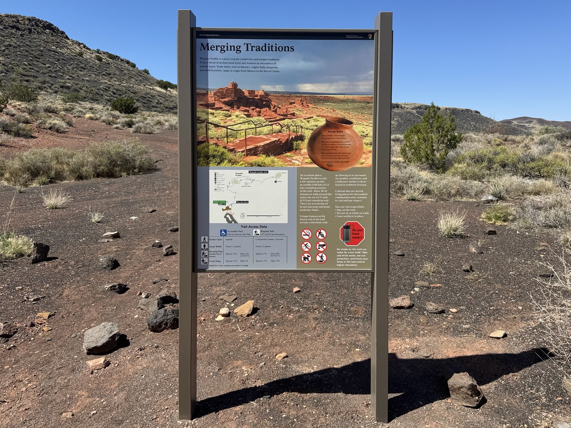
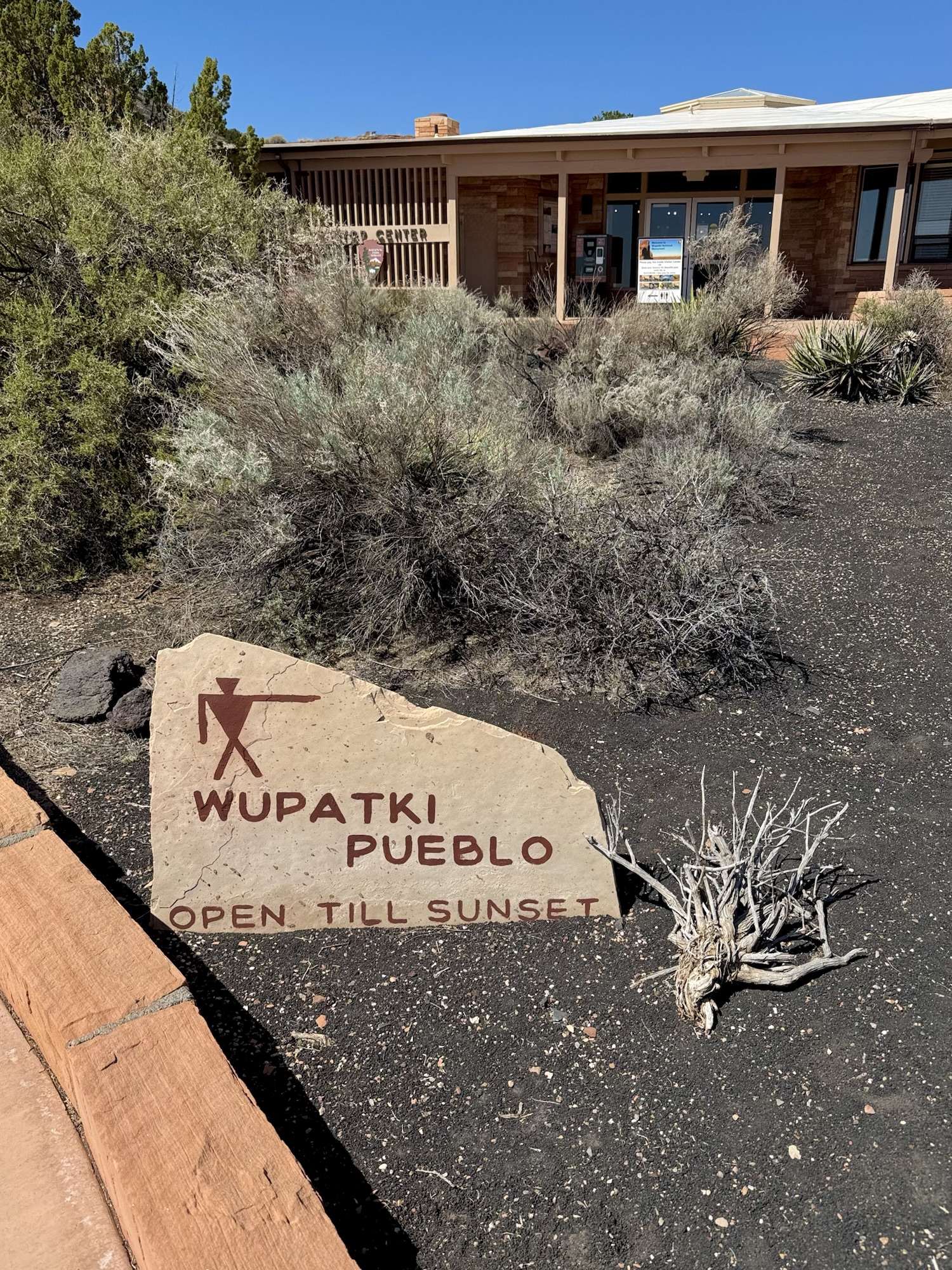
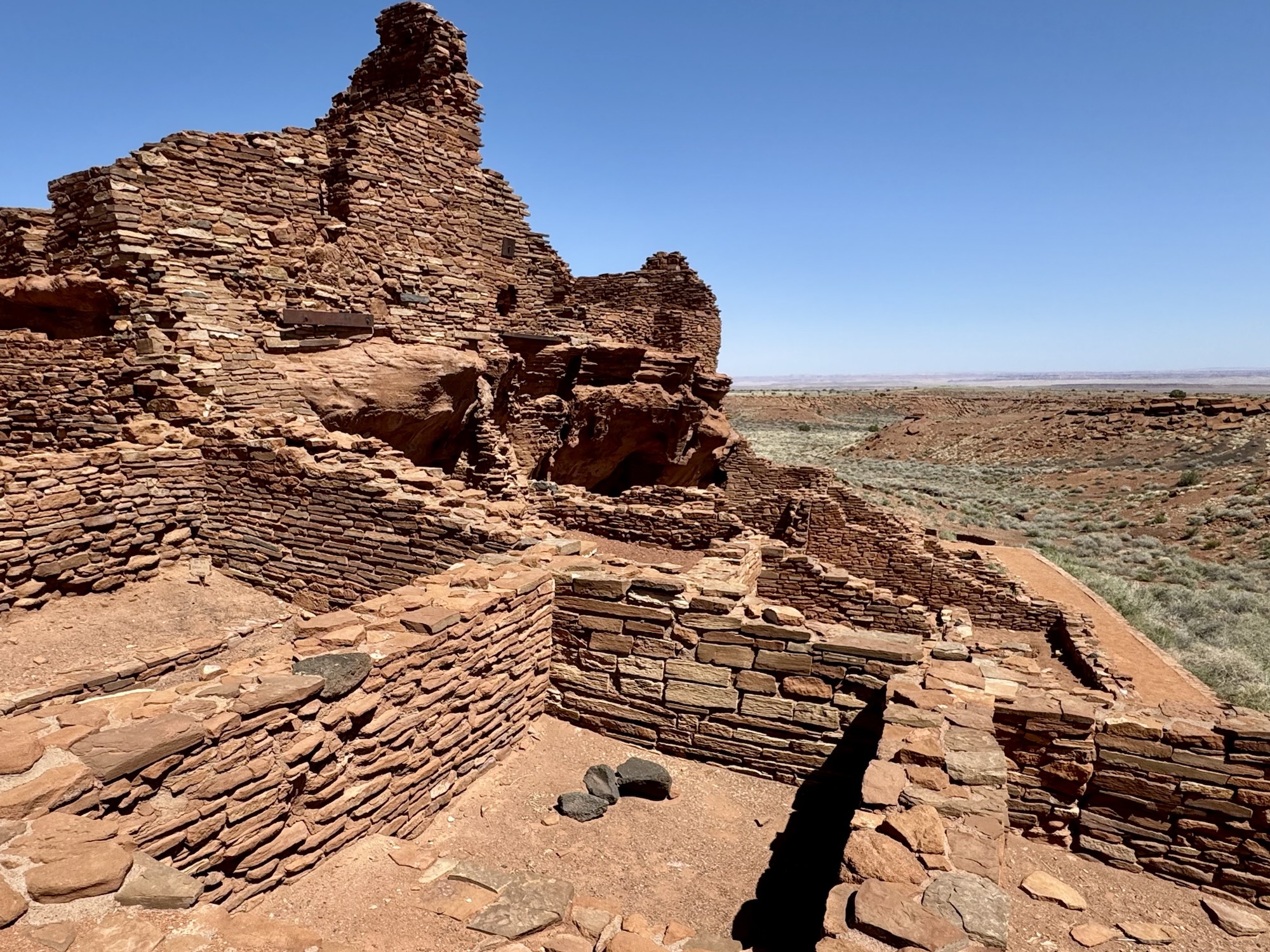
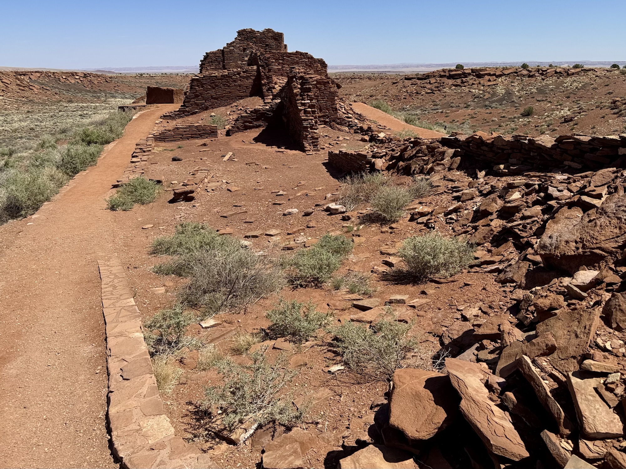
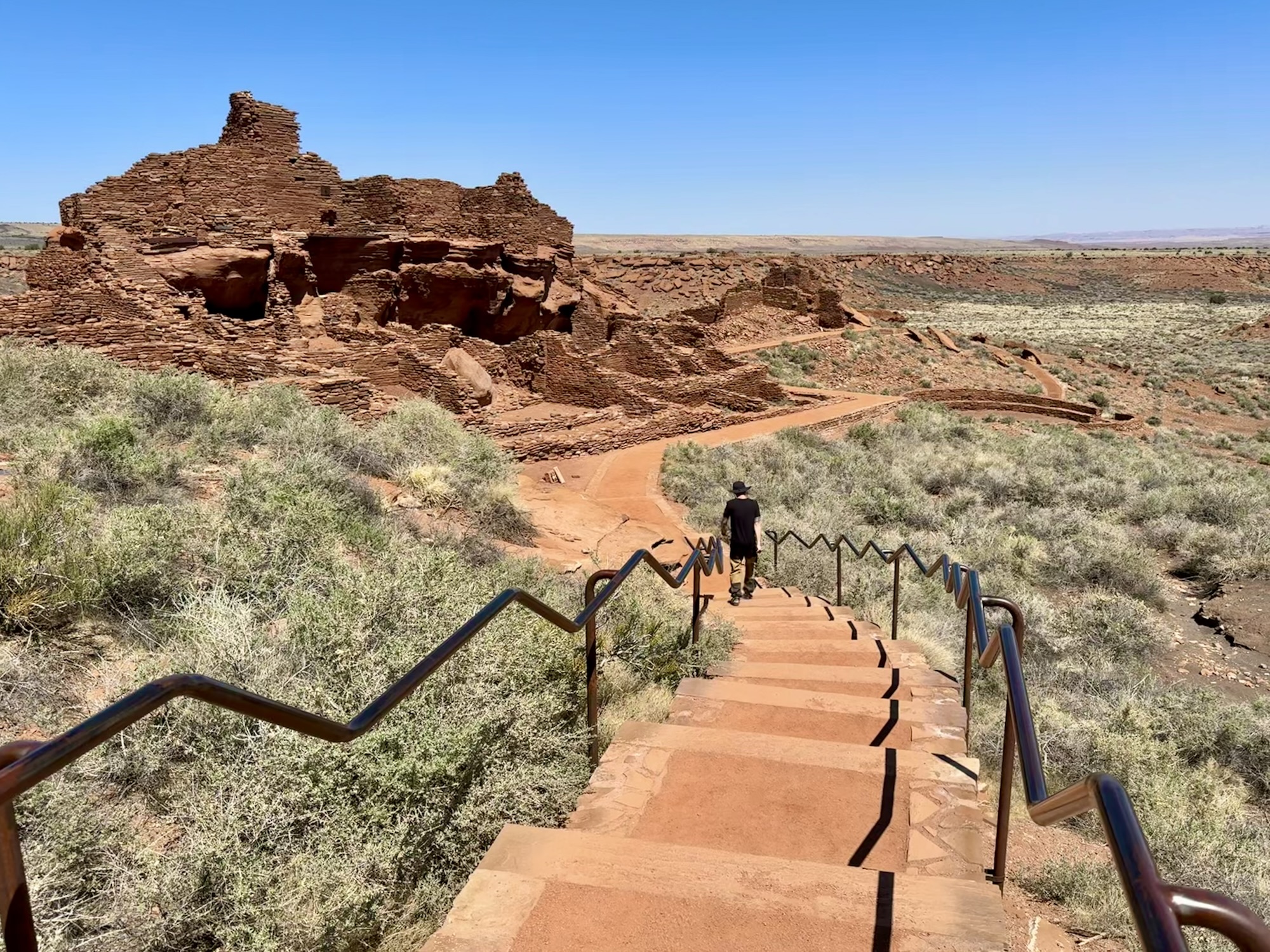
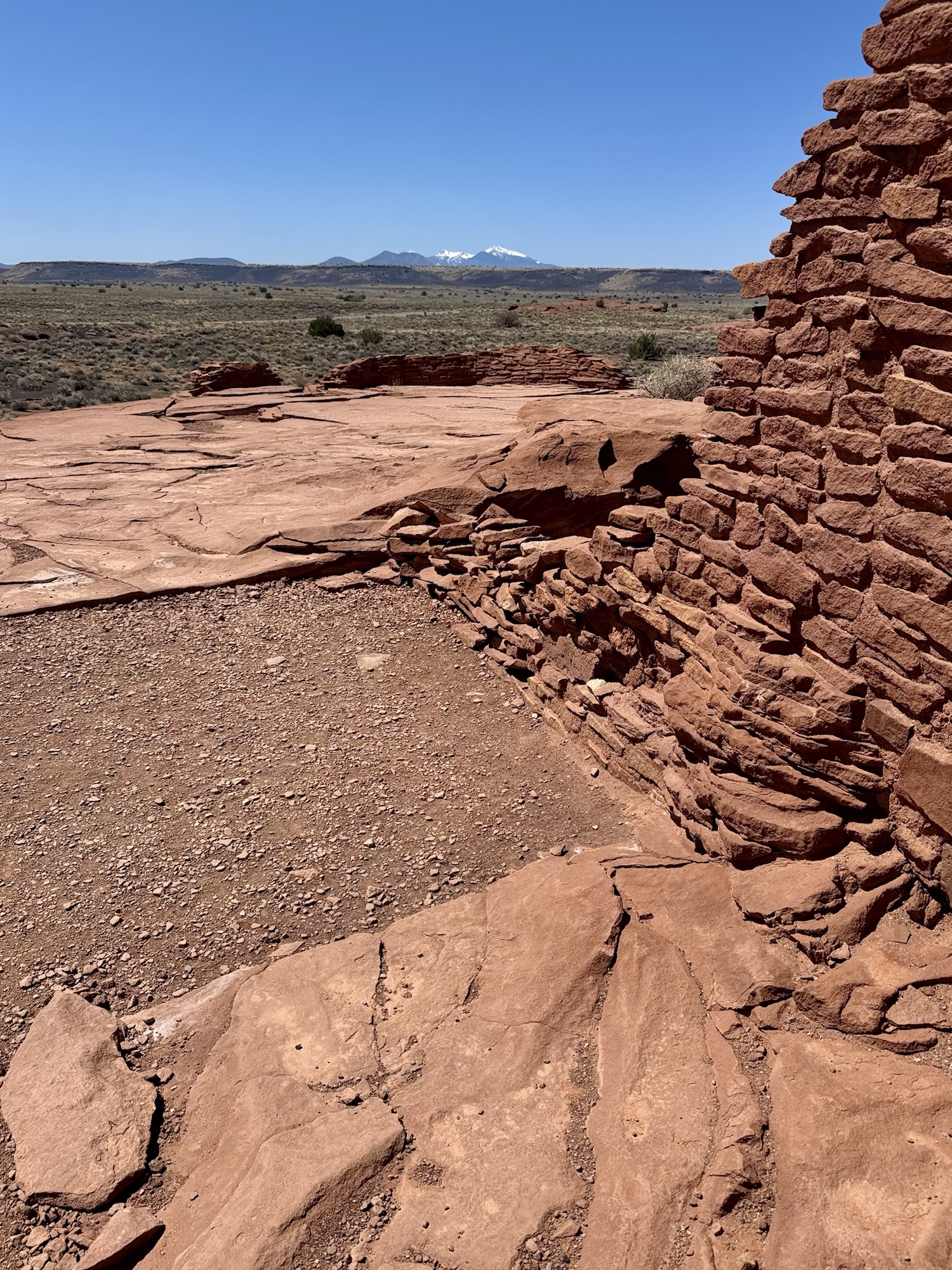
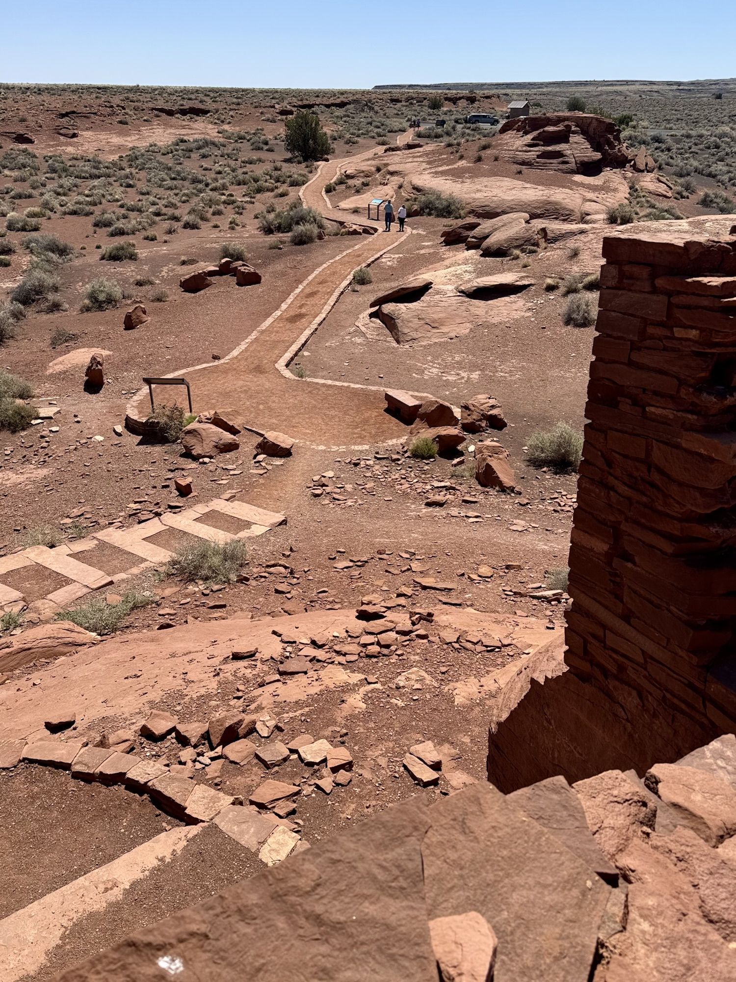
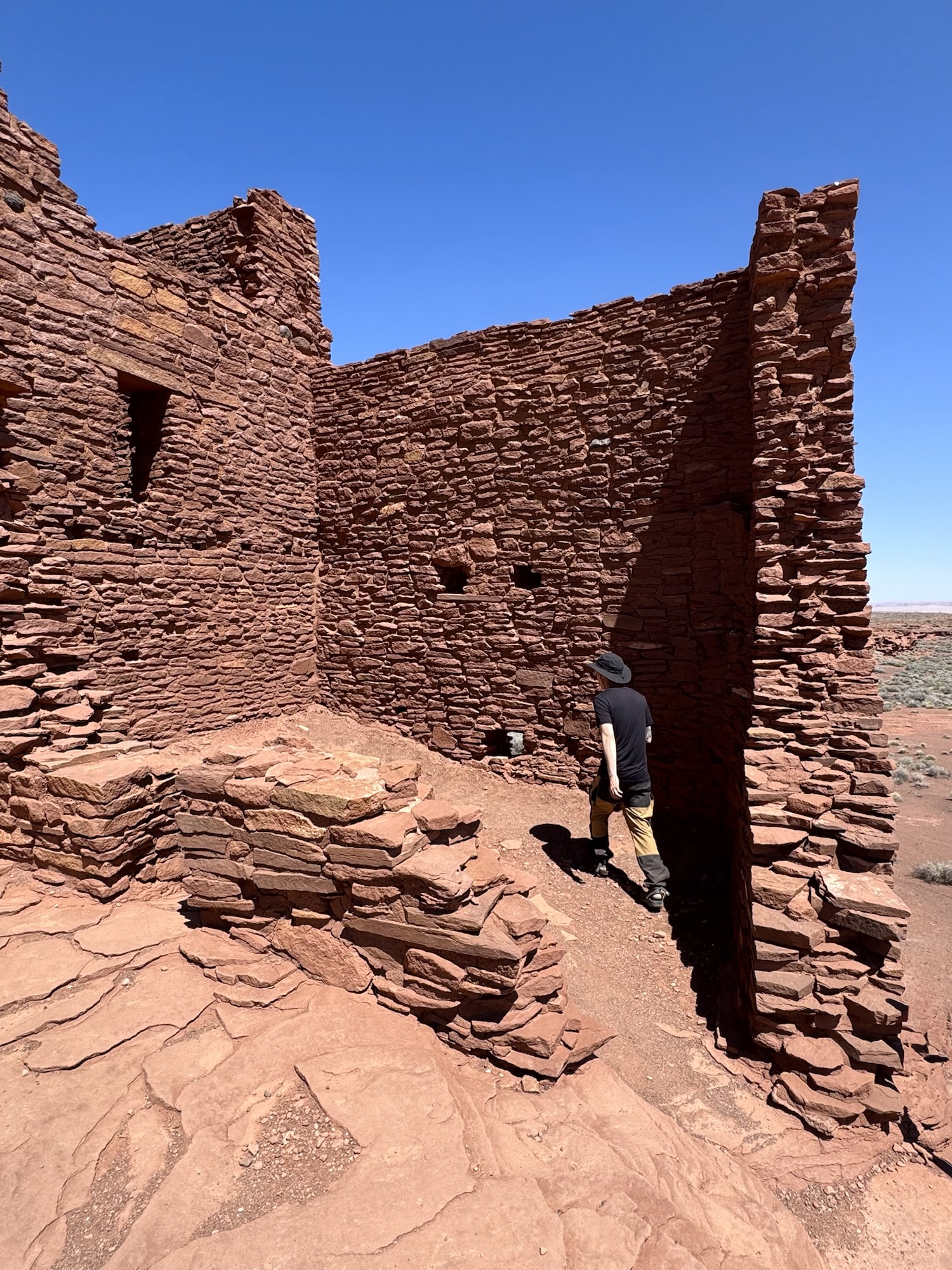
Wupatki Pueblo
The star of the show! Hence why the dropped the visitor center in front of it to protect it haha.
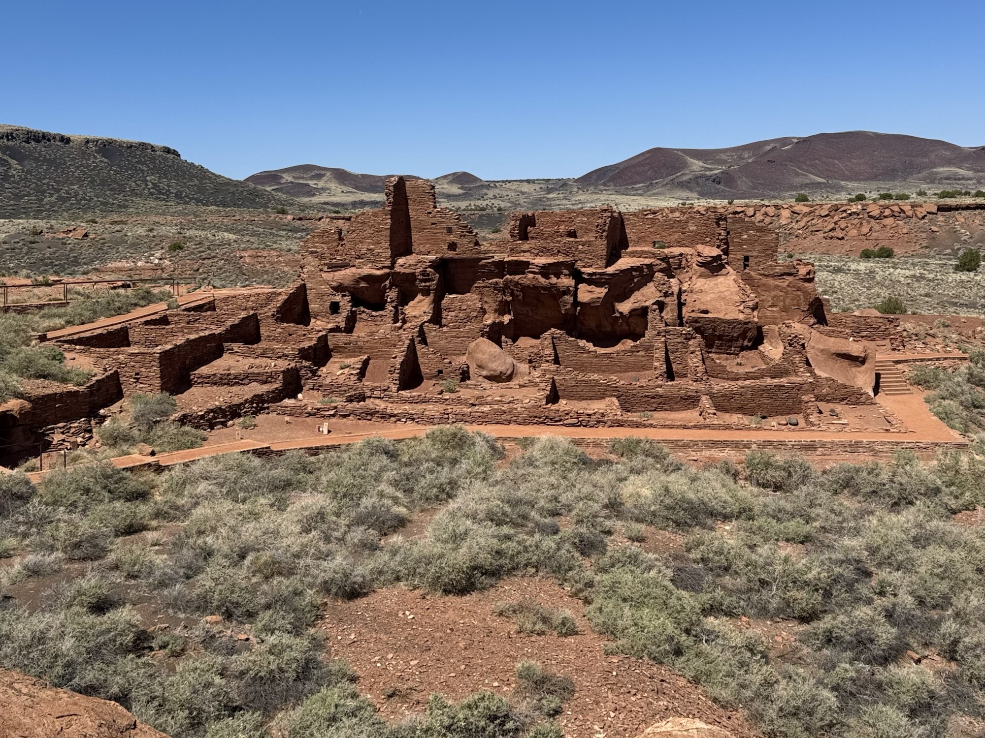

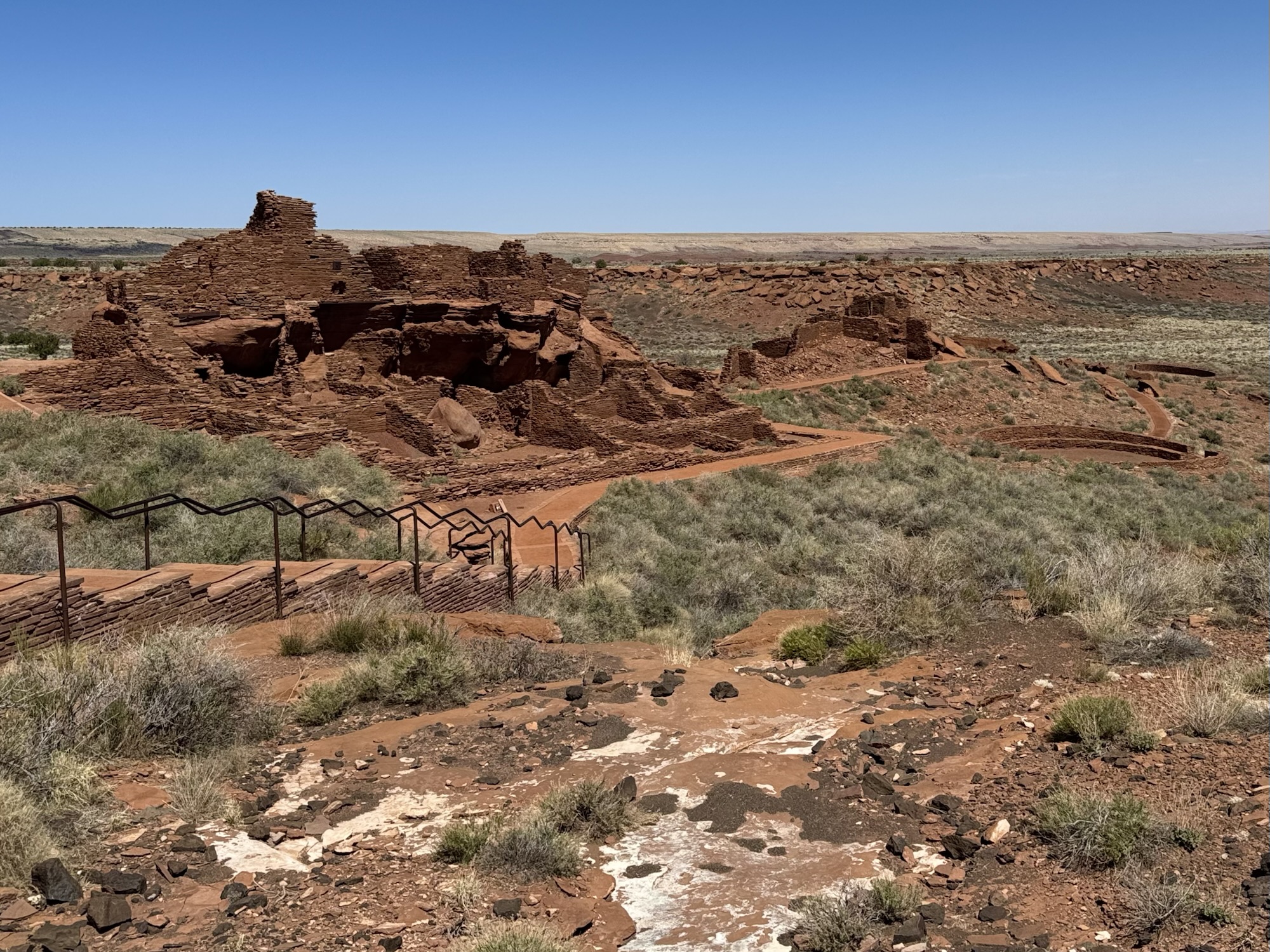
The scale is so insane. Imagine how bustling it must have been.
The two unique features of the Wupatki Pueblo are the ball court and the blow hole.
“Archaeologists believe a modified ball game, passed north from Mayan regions to the Hohokam in southern Arizona, was played within these masonry walls. Typical of other ballcourts, it is set apart from the pueblo indicating it was a public area and not used in daily community routines. It may have also been used for special events, gatherings, and ceremonies. Hopi identified this structure as a Snake Clan dance plaza and cistern since it retains seasonal rain for short periods of time.”

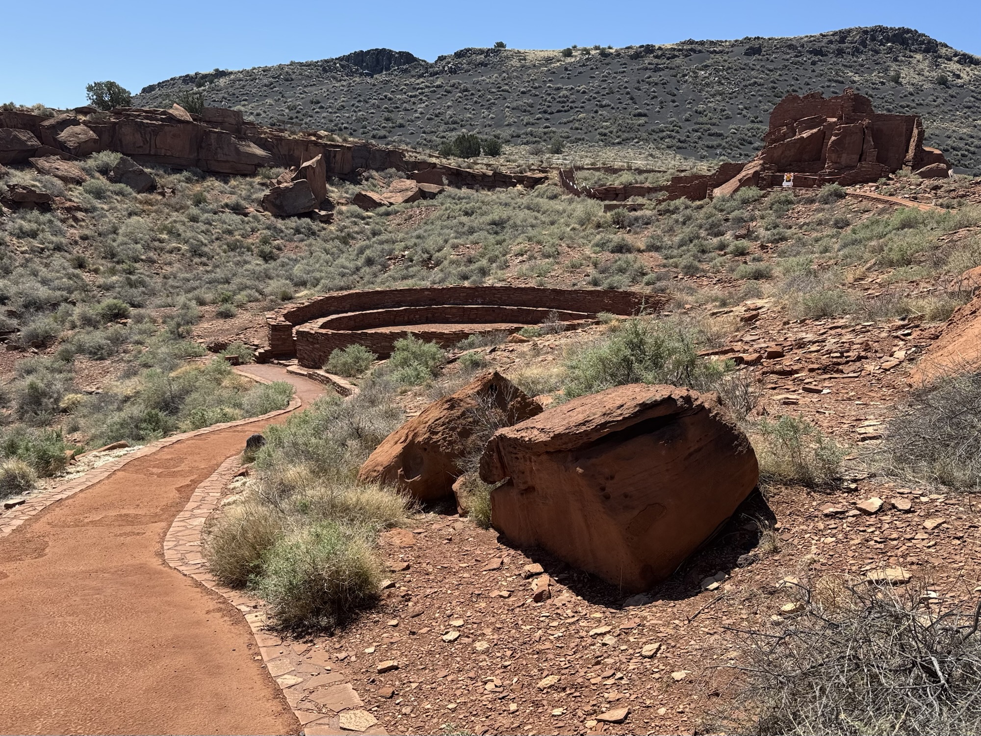
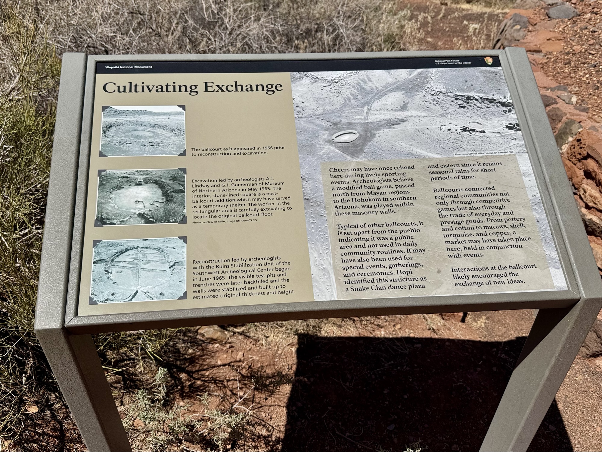
“Ballcourts connected regional communities not only through competitive games but also through the trade of everyday and prestige goods. From pottery and cotton to macaws, shell, turquoise, and copper, a market may have taken place here, held in conjunction with events. Interactions at the ballcourt likely encouraged the exchange of new ideas.”
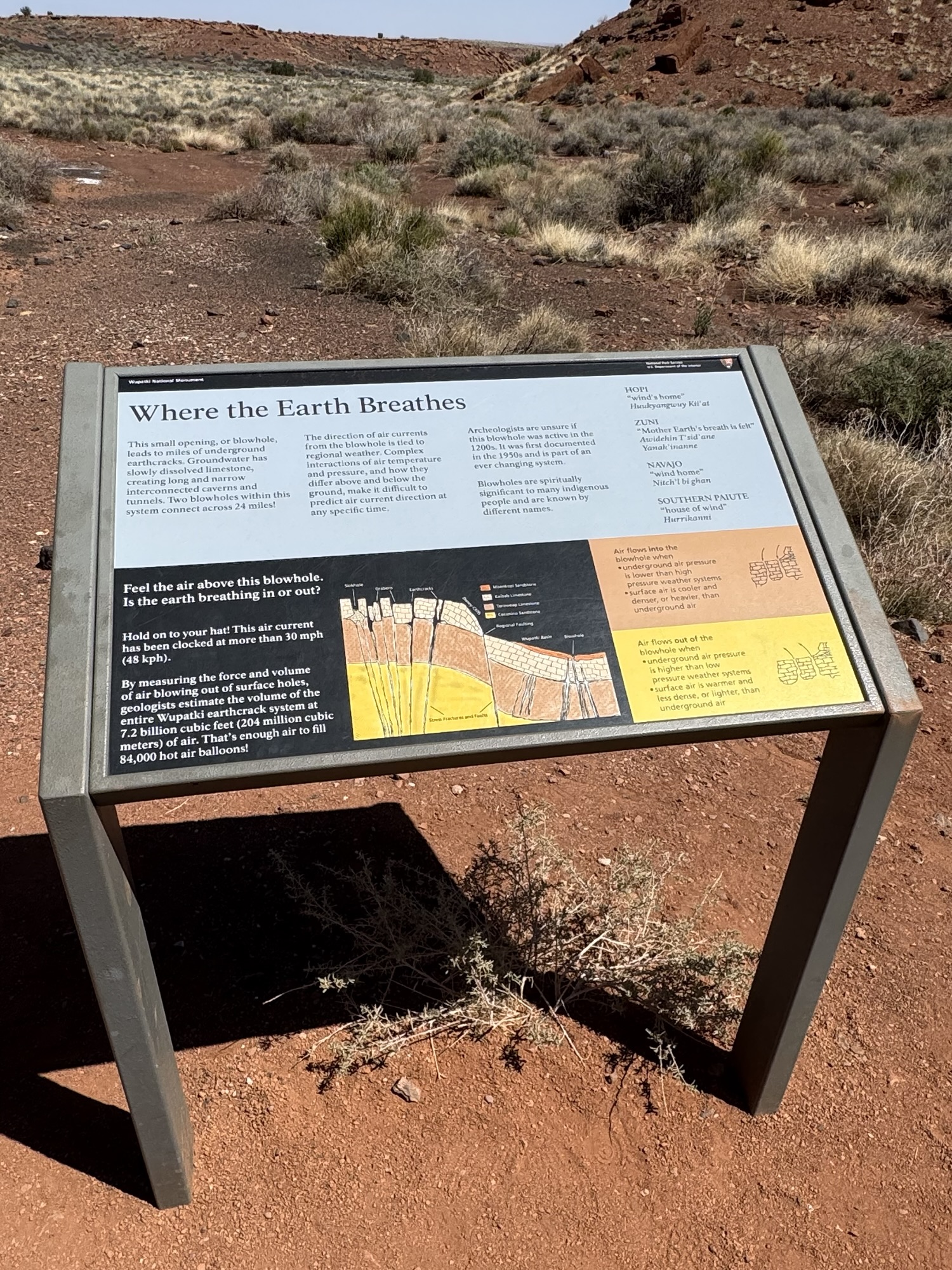


It was blowing so strongly, it cracked us up. So glad we had a random tissue on us to try it out with.
“This small opening, or blow hole, leads to mile of underground earthcracks. Groundwater has slowly dissolved limestone, creating long and narrow interconnected caverns and tunnels. Two blowholes within this system connect across 24 miles! The direction of air currents from the blowhole is tied to regional weather. Complex interactions of air temperature and pressure, and how they differ above and blow the ground, make it difficult to predict air current direction at any specific time.”

Byeeee 😉
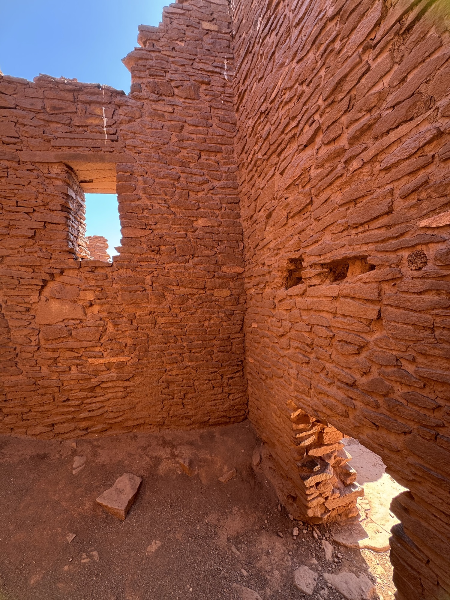
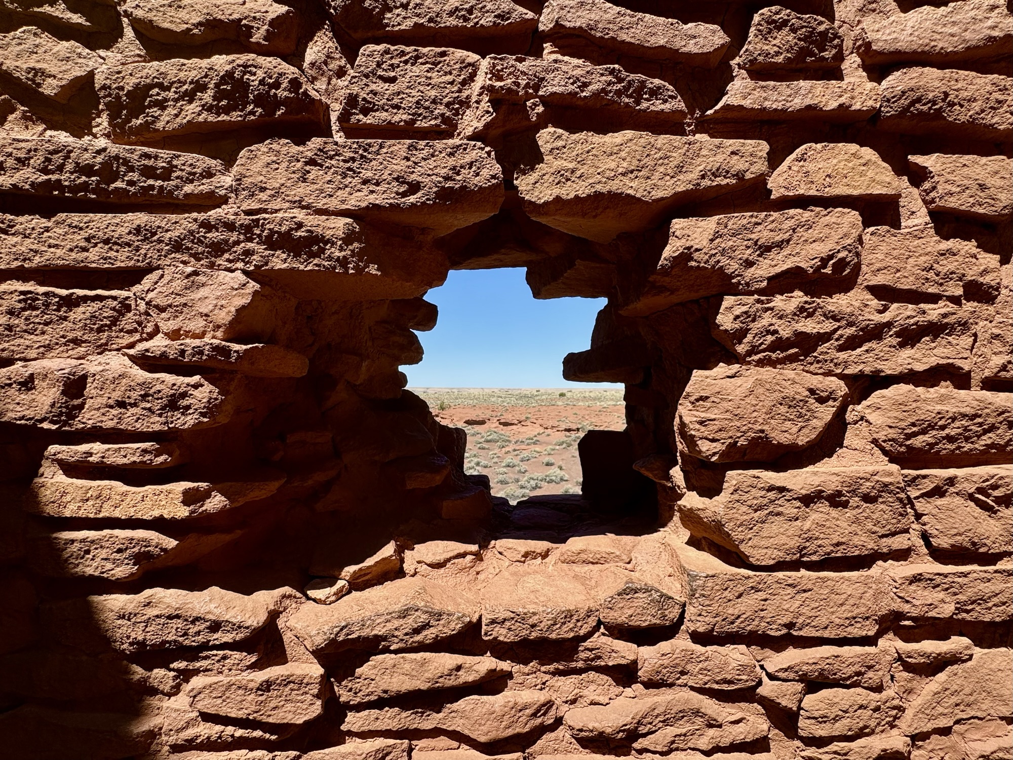
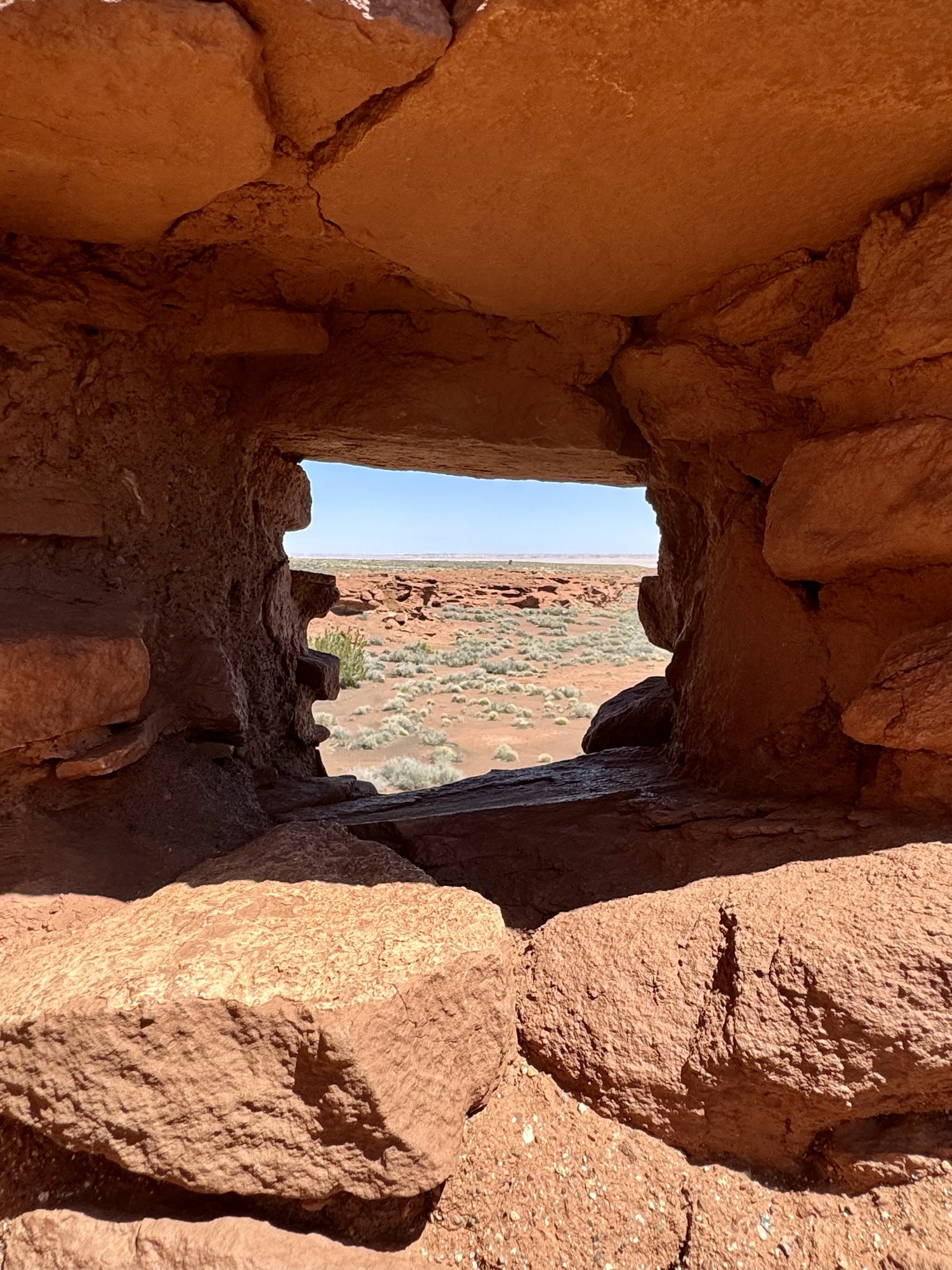
Wukoki Pueblo
Wukoki is basically a tiny castle. It’s awesome. (Are you getting tired of me saying that yet?)

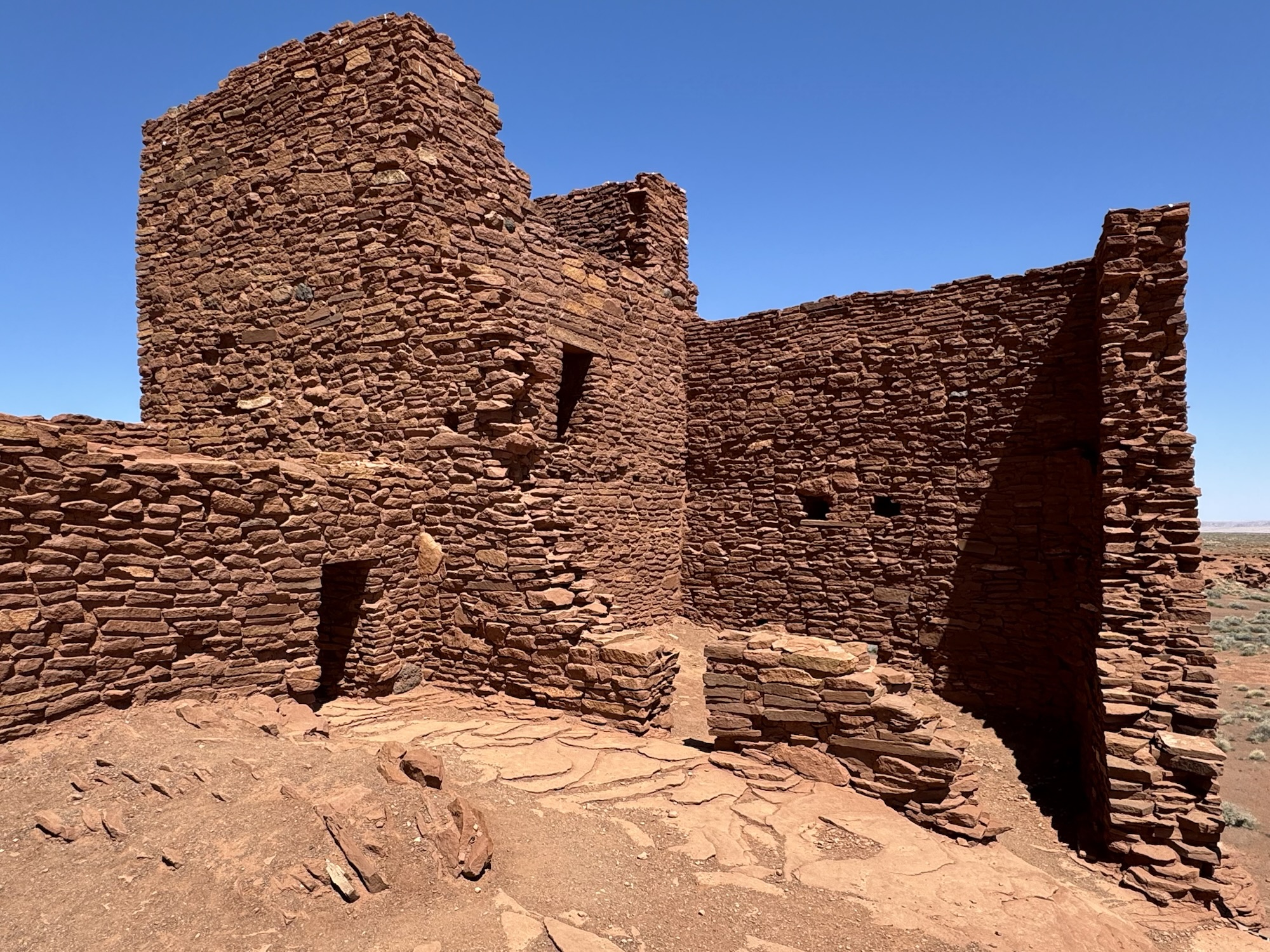
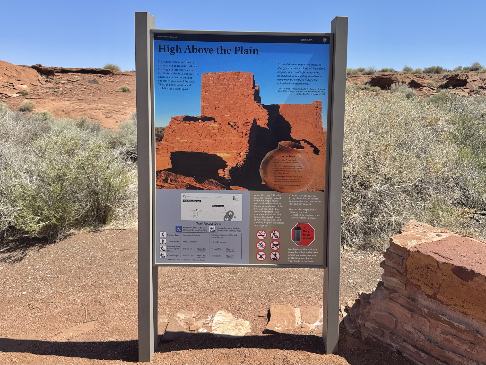
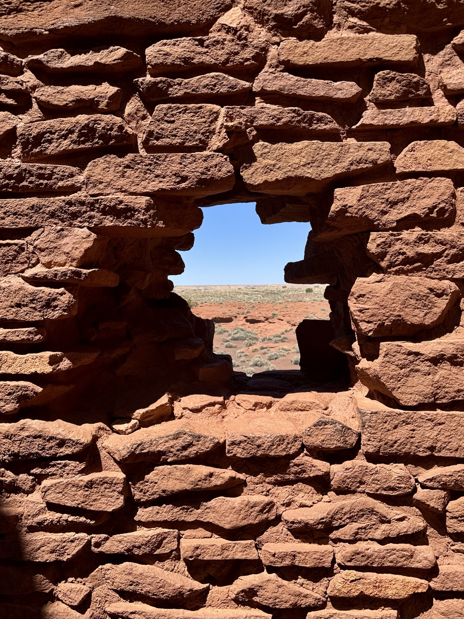
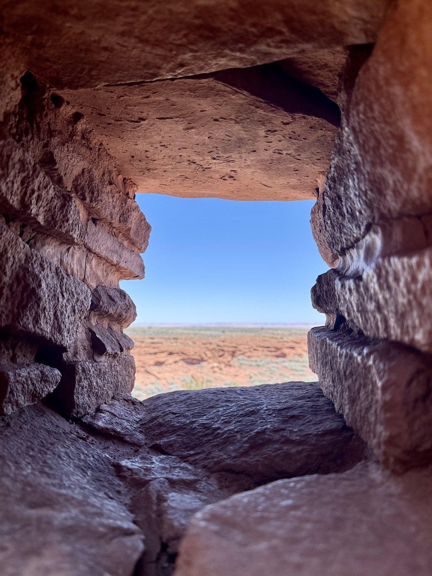
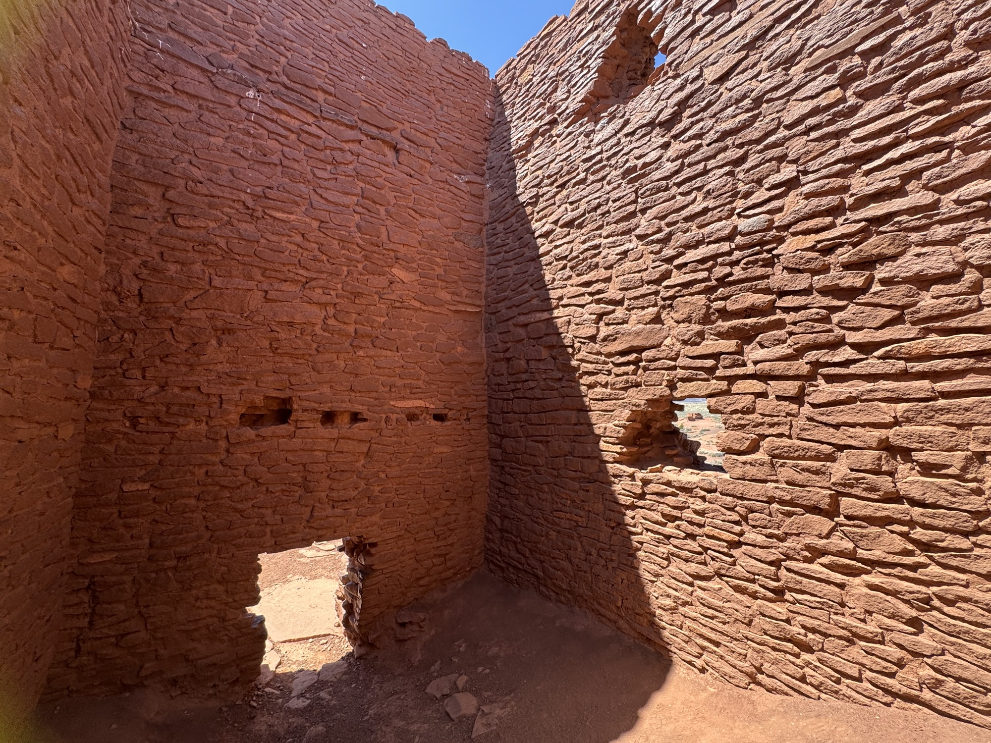
Wukoki is another one where you call walk entirely inside of it and scope it out from every angle. There are a lot of intact windows, so you know I loved looking out them and imagining people in the 1100’s doing the exact same thing. The structure used to be at least two floors and you can see the internal architecture that used to support wooden beams for the floor above.


By this point, we’d been at the Monument for a few hours – it was approaching noon and it was *so* hot. This was only in April so I can only imagine how blazing it gets later in the summer.


Pretty amazing, am I right?

Learn more about Lomaki & Box Canyon Pueblos via NPS:
https://www.nps.gov/places/lomaki-and-box-canyon-pueblos.htm
Learn more about Nalakihu & Citadel Pueblos via NPS:
https://www.nps.gov/places/citadel-and-nalakihu-pueblos.htm
Learn more about Wupatki Pueblo & Blowhole:
https://www.nps.gov/places/wupatki-pueblo-blowhole.htm
And about Wukoki Pueblo:
https://www.nps.gov/places/wukoki-pueblo.htm


Leave a comment